Aylesbury Vale Area Design Supplementary Planning Document
3.1.1 This chapter, 'Understanding the context' provides an overview of Aylesbury Vale, outlining much of what makes it distinctive and special.
3.1.2 It identifies many of the important characteristics that an applicant will be expected to consider to:
- Understand the context and character of their site; and
- Establish the constraints and opportunities that will guide their proposals.
3.1.3 Applicants will be required to demonstrate a clear link between their appraisal of the context, any applicable planning designations, the character of their site, physical constraints and opportunities and their development proposals. This link or rationale will need to be articulated through the Design and Access Statement and any other document that will support their planning application.
3.1.4 Applicants will be expected to make use of a range of tools to support their analysis including figure ground studies, space syntax analysis, historic maps and local precedent studies detailing typologies and materials.
The Design and Access statement will include a character study and a site appraisal and this chapter sets out the basis for the information required to produce them.
3.1.5 The steps required in this process to understand the context of a site are set out in the flow chart in Figure 3.1.
3.1.6 A checklist is provided at the end of the section providing prompts to applicants on the issues that may be relevant and that require consideration in understanding their site and the context within which it is located.
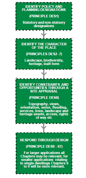
Figure 3.1: Flow chart indicating the process applicants should follow to 'Understand the context' of their site
3.2 Overview of the area
3.2.1 Aylesbury Vale covers an area of approximately 90,000 hectares and is a largely agricultural area extending from the Chiltern Hills and Wycombe in the south towards Milton Keynes and Northamptonshire to the north. Oxfordshire is to the west and Hertfordshire and Bedfordshire to the east.
3.2.2 Aylesbury Vale is characterised by low-lying vales and clay plateaus, interrupted by distinctive low hills and ridges. The chalk scarp of the Chilterns AONB to the south-eastern boundary of the area provides a prominent backdrop to views in much of the southern part of the Vale.
3.2.3 The underlying geology informs both the landscape and the rich and varied vernacular architecture of the area's many villages and towns.
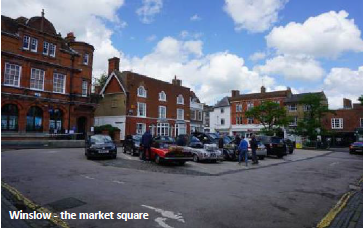
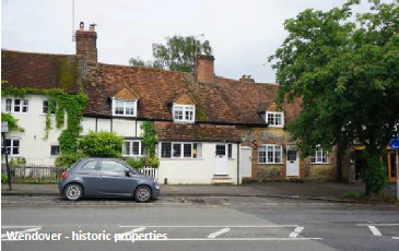
3.2.4 The Vale's main settlements, Buckingham, Winslow, Aylesbury and Wendover are located along the A413 which runs north-south through the area, with Haddenham to the west on the A418 that connects Aylesbury with Oxford. Other important routes include the A418 and A41 which meet at Aylesbury and the A421 which extends east west across the northern part of the Vale. Beyond these routes the area is characterised by a network of smaller roads and lanes with larger arterial routes, the M40 and M1 skirting the edge of the area to the east and west.
3.2.5 The West Coast mainline crosses the eastern edge of Aylesbury Vale and regional trains serve stations towards the south of the area.
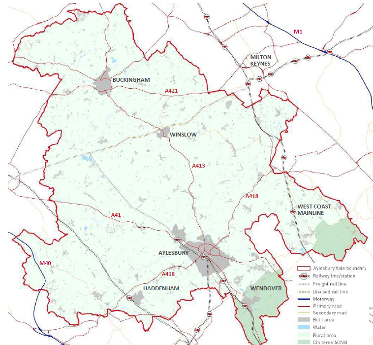
Figure 3.2: Aylesbury Vale Overview Plan
3.2.6 Aylesbury, located towards the south of the area, is the main settlement and the historic market town provides a focus for shopping and employment. It has a growing cultural scene and was the birthplace for the paralympic movement. The town is home to the national centre for disability sports and to the University Campus Aylesbury Vale (UCAV).
3.2.7 The area's environment is protected by a number of local, national and international designations which seek to preserve the area's natural and built environment for future generations.
3.2.8 Aylesbury Vale also has many sites valued for their biodiversity including a Special Area of Conservation (SAC) at Chiltern Beechwoods, 28 Sites of Special Scientific Interest, over 200 Local Wildlife Sites, Local Nature Reserves and Biodiversity Opportunity Areas. The area has approximately 3,000 listed buildings, over 60 scheduled monuments, over 80 conservation areas and 13 registered historic parks and gardens. There are also numerous non-designated heritage assets within the area.
3.2.9 Applicants will need to carry out their own desktop analysis to understand whether their site is covered by any designations.
3.2.10 Applicants should check the National Heritage List for England (NHLE) for nationally designated heritage assets, and AVDC Guidance on heritage, trees and conservation for advice about listed buildings, conservation areas and non-designated heritage assets.
3.2.11 Find information on AVDC's tree strategy, protection of trees and hedgerows, wildlife and conservation on the council website. Go to council website
Principle DES1: Designations
Applicants should clearly identify whether their site lies within or in the setting of any statutory or non- statutory designation. Any development proposals within or in the setting of one or more of these designations will be required to demonstrate how the proposals respond to national and local policies relevant to that particular designation.
3.2.12 The Buckinghamshire Historic Environment Record (HER) is a rich source of information on the area's landscapes, places, buildings, monuments and archaeology. Their records can be searched using the online map and database at Buckinghamshire's Heritage Portal, Go to Buckinghamshire Heritage website
3.2.13 The area has a significant number of Neighbourhood Plans and applicants should refer to these for detailed local information in their context analysis as well as to determine the local policies. Some provide relevant information on the designations, assets and/ or settlement character of the area and some also set detailed design policies.
3.2.14 Designations and features that help to characterise Aylesbury Vale are identified in Figures 3.3 to 3.10 on the following pages.
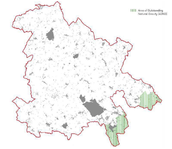
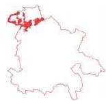
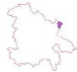
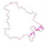
Figure 3.3: Areas of Outstanding Natural Beauty
Chilterns AONB
VALP Policy references: NE3; NE4
Area: 4,665Ha (5.2% of Aylesbury Vale)
Character: Elevated land, sometimes wooded, with a steep chalk escarpment that offers panoramic views northwards across the area.
Importance: Any development within the AONB must conserve and enhance its distinctive features. Land outside of the AONB contributes to its setting and development should not adversely affect views in and out of the AONB.
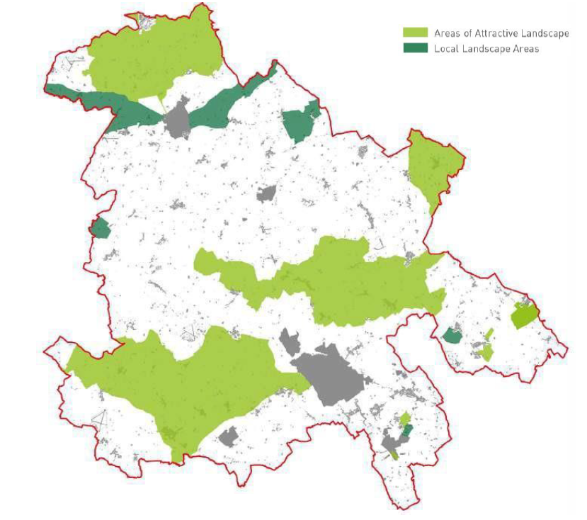
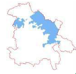
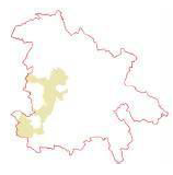
Figure 3.4: Areas of Attractive Landscape / Local Landscape Areas
Areas of Attractive Landscape / Local Landscape Areas
VALP Policy references: NE3; NE4
Area: 27,768Ha (30.8% of Aylesbury Vale)
Character: varies dependent on location within the area
Importance: Local landscape designations. Areas of Attractive Landscapes (AAL) have 'County wide' landscape value and are designated for their 'scenic beauty, nature conservation interest and amenity value'. Local Landscape Areas (LLA's) have area wide value and are designated for their special contribution to the appearance and the character of the landscape within Aylesbury Vale
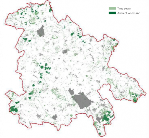
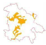
Figure 3.5: Tree cover / ancient woodland
Tree cover / ancient woodland
VALP Policy references: NE1; NE2; NE8
Area: 7,407 / 2,184Ha (8.2 / 2.4% of Aylesbury Vale)
Character: Broadleaved and ancient woodland is concentrated in the south within the Chilterns AONB, north of Buckingham within Whittlewood Forest and in the west of the area throughout Waddon Chase. Priority wood pasture and parkland is most notably at Stowe Park in the north. Traditional orchard is found in small, fragmented parcels particularly to the east.
Importance: Woodlands provide vital habitat and support for wildlife as well as resilience to, and buffering of climate change. Woodlands often play a role in softening and enhancing settlement and built form, and can provide a sense of seclusion and tranquility.
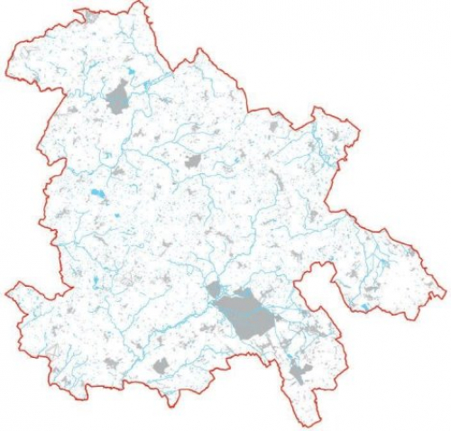
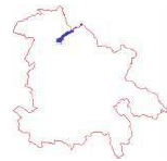
Figure 3.6: Water and rivers in Aylesbury Vale
Water and rivers
VALP Policy references: NE1; NE2; NE8
Area:770Ha (0.9% of Aylesbury Vale)
Character: The extensive network of watercourses running from the area's higher ground to its valleys are an important feature of the landscape. The main watercourses in the area are the River Thame (a trbutary of the River Thames and the River Great Ouse. The Grand Union Canal passes through Aylesbury Vale with a spur terminating in Aylesbury town centre. The Wendover Arm is currently undergoing restoration.
Importance:The area's watercourses enhance character and biodiversity and should be retained, protected and enhanced within development.
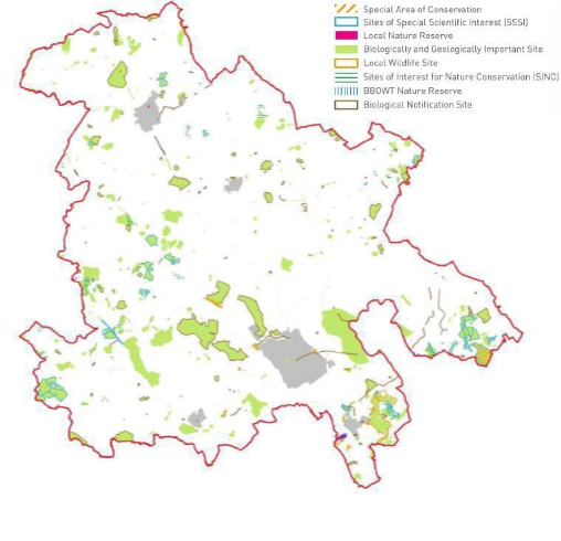
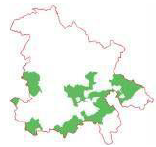
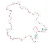
Figure 3.7: Nature conservation designations
Nature conservation / biodiversity
VALP Policy references: NE1; BE1
Area: 8,767Ha (9.7% of Aylesbury Vale)
Character: The designated site network is concentrated within the south east and western borders of the area, taking in priority habitats of deciduous woodland, lowland meadow and heathland.
Importance: International and national designations protect the best semi-natural wildlife habitats in the area and are home to many of the rarest, threatened and protected species. Local wildlife sites, country wildlife sites and BBOWT reserves support the higher designations, serving as stepping stones and connecting corridors for biodiversity, as habitat buffers, and to dilute the pressures on habitats such as those that arise from recreational use.
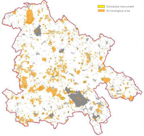
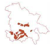
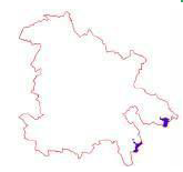
Figure 3.8: Archaeological designations
Archaeology
VALP Policy references: NE1; BE1
Area:12,556Ha ( 14.0% of Aylesbury Vale)
Character: Varies
Importance: Aylesbury Vale is rich in archaeology reflecting its history and includes 61 scheduled monuments. Scheduled monuments are designated for their national importance under the 1953 Historic Buildings and Ancient Monuments Act.
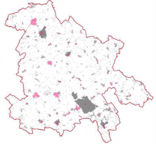
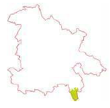
Figure 3.9: Conservation area designations
Conservation areas / heritage
VALP Policy reference: BE1
Area:2,227Ha (2.5% of Aylesbury Vale)
Character:Characteristics of each of the 83 conservation areas are described on the council's website. Further guidance can be found in Conservation Area Character Appraisals and the Conservation Management Plan.
Importance:Designated for their special architectural or historic interest. The area also includes over 3,000 listed buildings (Refer to section 4.3 for detail on how to respond to listed buildings when preparing development proposals). and a local list of non-designated heritage assets
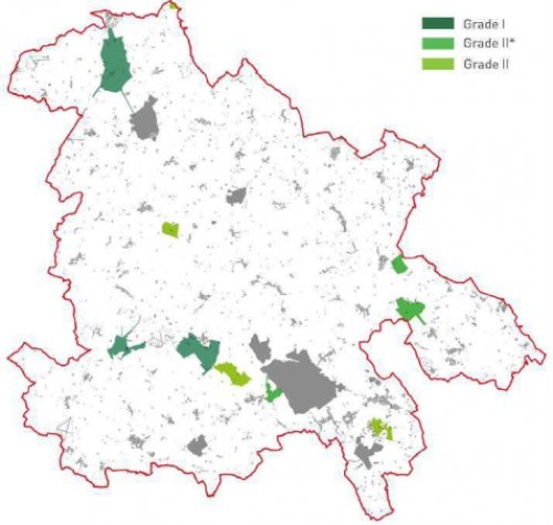
Figure 3.10: Registered Parks and Gardens
Historic parks and gardens
VALP Policy reference: BE1
Area:2,534Ha (2.8% of Aylesbury Vale)
Character: Designed landscapes often associated with country houses (11 wholly within Aylesbury Vale including the Grade I Stowe, Waddesdon Manor and Wotton House)
Importance: The register of parks and gardens, established in 1983, identifies landscapes of national interest and their designation gives them equal policy status with listed buildings and scheduled monuments.
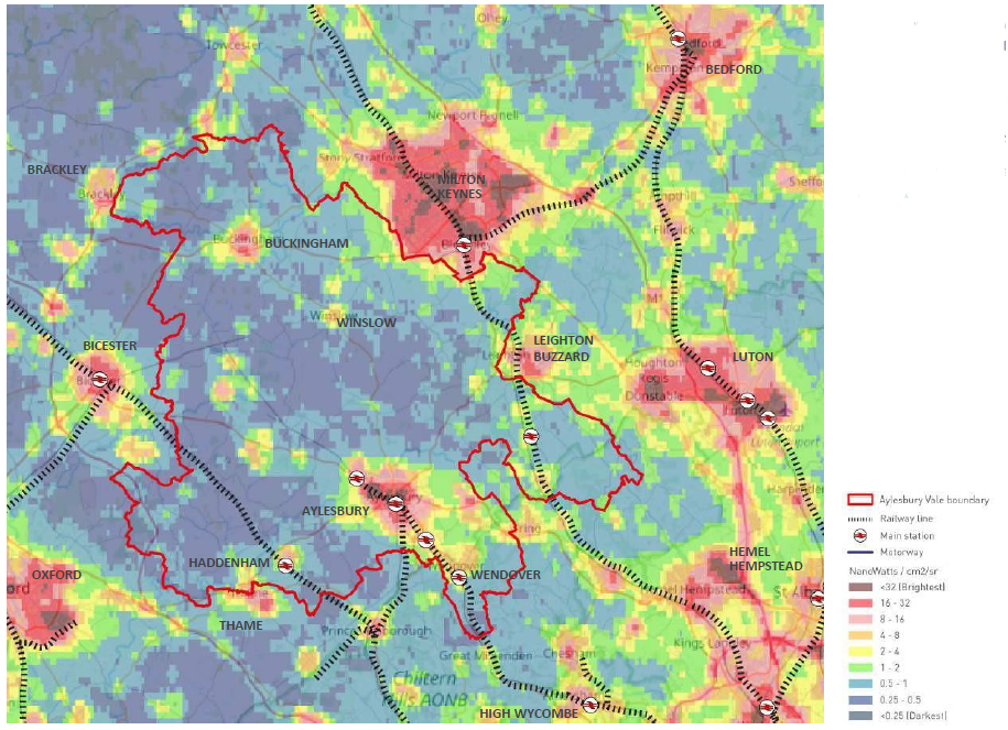
Figure 3.11: Aylesbury Vale dark skies / tranquillity
3.2.15 Whilst Aylesbury Vale is close to Greater London and is bordered by Milton Keynes, Bicester and Oxford the heart of the area has dark skies allowing views of the Milky Way and creating a sense of rural tranquility. It is noteworthy that the area has darker skies than the Chilterns AONB to the south.
3.2.16 Dark skies can have value for nocturnal wildlife such as barn owls, bats and badgers, many of which are protected species.
3.3 Landscape character
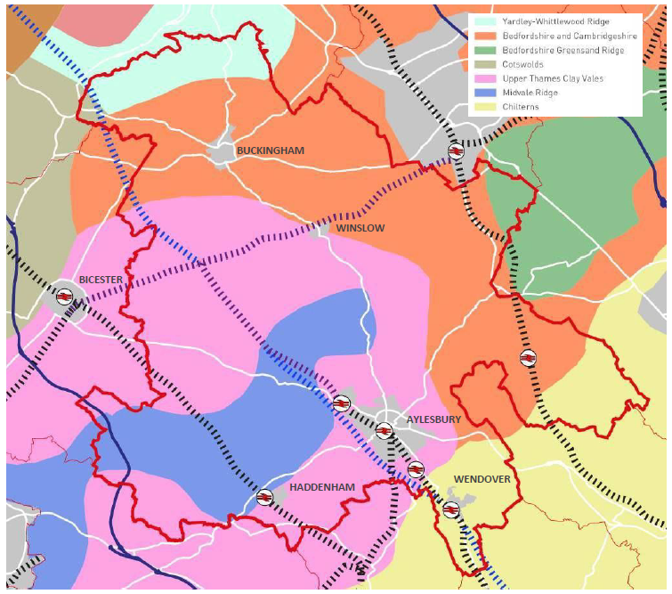
Figure 3.12: Aylesbury Vale underlying geology
3.3.1 Aylesbury Vale has a varied and distinct landscape character influenced by the underlying geological formations, influencing soils and the overlying pattern of watercourses and vegetation. This shapes our built environment, from land use and settlement pattern, to the building materials used in historic construction.
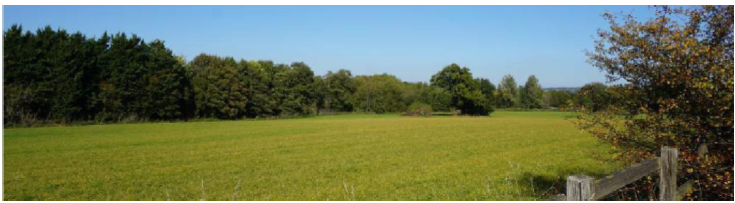
3.3.2 The Vale has a predominantly rural character whilst accommodating the main settlements of Buckingham in the north, Winslow in the central part of the area, and Aylesbury, Haddenham and Wendover in the south. The area is characterised by its gently undulating clay plateau landform, which is dissected by ridges and low-lying hills.
3.3.3 The Vale contains six National Character Areas (NCAs) which reflects the diversity of this landscape. Within the south and the west of the area, the lowland topographic areas fall under the Upper Thames Clay Vales (NCA 108), whereas the north and east is characterised as Bedfordshire and Cambridgeshire Claylands (NCA 88).
3.3.4 Both character areas typically have a gently undulating landscape shaped by watercourses. Large- scale, arable practices within a regular field pattern dominates the Bedfordshire and Cambridge Claylands. On the other hand, pastoral farming is more prevalent within the Upper Thames Clay Vales, due to the heavy clay soils. A mosaic of semi-natural habitats covers these character areas including wetlands, fen, reedbeds, wet woodland, ancient woodland and unimproved grassland.
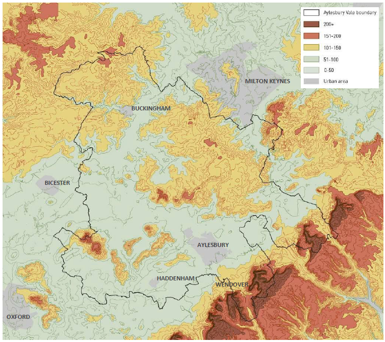
Figure 3.13: Aylesbury Vale topography
3.3.5 The Chilterns (NCA 110) makes up the southern boundary of Aylesbury Vale, with its steep chalk escarpment creating an abrupt contrast to the surrounding low-lying vales. The Chilterns NCA is largely designated as an Area of Outstanding Natural Beauty (AONB), boasting dramatic and panoramic views to the surrounding countryside, making it a popular location for recreation.
3.3.6 Running parallel to the north of the Chilterns, the Midvale Ridge (NCA 109) and the Bedfordshire Greensand Ridge (NCA 90) form elevated ridges that contrast with the surrounding flat countryside.
3.3.7 The Midvale Ridge is a densely wooded limestone ridge which hosts both arable and pastoral farming practices, whereas the Bedfordshire Greensand Ridge sees a steep scarp which has been incised by rivers to create distinctive valleys with riparian habitats. Forming the northern boundary of the area, the Yardley Whittlewood Ridge (NCA 91) gives a further topographical contrast to the low claylands of the Vale. The gently undulating limestone ridge offers extensive views across the surrounding countryside and a rich variety of semi-natural habitats, whilst having a dominance of medium-scale, arable farming.
Local Landscape Typologies and their characteristics
3.3.8 The local landscape character assessment divides the Vale into 13 Landscape Character Typologies (LCT) derived from the National Character Areas. These are summarised below together with a thumbnail image that identifies the location of each. Larger plans that inidicate how each landscape character area relates to existing settlements are provided in Appendix B.
3.3.9 The assessment further characterises each LCT into 79 distinct Landscape Character Areas which provides more detail on the distinct landscape features and key characteristics. Refer to the council's website for full details. In the Chilterns AONB and/ or the locally designated Areas of Attractive and Local Landscape Areas, reference should be made to their Special Qualities.
Principle DES2: Landscape character
Applicants should identify the Landscape Character Typology and Area in which their site is located. An understanding of the key characteristics of the landscape should guide and influence design development, including but not limited to identifying suitable site layout and connectivity, scale and massing, materials and detailing.
Aylesbury Vale landscape character typologies
 Typology: LCT 01 Wooded Ridge
Landform and views: A broad and gently undulating ridge which lacks dramatic landform, however incised valleys mark the plateau margins. Views are generally contained by woodland.
Vegetation: Coniferous and broad-leaved woodland give dense land coverage. Ancient woodland blocks and a strong hedgerow pattern with mature oak trees sit alongside this.
Settlement and materials: The dispersed settlement pattern and meandering lanes add to the tranquil character. Local vernacular
and traditional building materials of limestone, timber and predominantly red brick.
 Typology: LCT 02 Incised Valleys
Landform and views: Small, steep and narrow valleys created from the incision of the Great Ouse. Landform limits views and visual detractors arise from main roads and arable farming.
Vegetation: Ecological interest is created from the base-rich ferruginous fens and scattered woodland. Oak and some ash dominate alongside ground flora typical Great Ouse river before dispersing up-slope as arable
roads and arable farming. to ancient woodland.
Settlement and materials: Historic settlement in traditional materials of limestone, timber and red brick, and field pattern, including isolated farmsteads, is focused along the Great Ouse river before dispersing up-slope as arable farming becomes the dominant land use.
 Typology: LCT 03 Valley Bottom
Landform and views: The wide floodplain straddling the Great Ouse is coupled with gently sloping topography. Views are generally trees, shrubs, grasses, reeds and small up the valley sides. The low density of typically red
constrained by landform, and pylons and roads act as visual detractors.
Vegetation: Great biological interest is found within bankside vegetation, wetland trees, shrubs, grasses, reeds and small woodland pockets. Distinctive willows overhang the meandering river.
Settlement and materials: Intimate and enclosed landscapes exist along the river, turning to large-scale arable farming further up the valley sides. The low density of typically red brick and timber settlement includes traditional weirs and mills.
 Typology: LCT 04 Undulating Clay Plateau
Landform and views: The rolling landform of the clay plateau is shaped by a series of shallow rides and valleys. View within the LCT are contained by landform; however the plateau margins provide extensive vistas.
Vegetation: Many fen sites comprise a variety of herb and grass species. Woodland blocks in the north contain a large proportion of ancient woodland and clipped hedges are dominated by oak and ash trees.
Settlement and materials: Historic villages which are accessed by winding lanes. The landscape structure is enhanced by the vernacular buildings which use a variety of materials including timber, brick and thatch.
 Typology: LCT 05 Shallow Valleys
Landform and views: Shallow and poorly defined valleys incise the gently sloping or flat landscape, giving limited views over the LCT. Significant visual detractors come from the network of pylons and the railway.
Vegetation: Biodiversity interest predominantly comes from the river corridor. Pollarded willows and black poplars are important local tree species. Grassland cover dominates with strong hedgerow pattern. Woodland is sparse.
Settlements and materials: Overall lack of settlement, however some well- preserved, historic, nucleated villages are limited to marginally higher ground. Buildings often limestone, red brick or rendered. Limited road access is coupled with historic and industrial relics, resulting in a
remote and tranquil area.
 Topology: LCT 06 Greensand Ridge
Landform and views: A distinct wooded scarp which has been eroded into an undulating landform, creating steep valleys and small promontories. Long distance views towards Milton Keynes and extensive views over the Ouzel valley.
Vegetation: Extensive woodland cover consists of ancient semi-natural woodland, secondary woodland and coniferous plantations. Heathland and acidic grassland habitats can also be found.
Settlement and materials: Narrow and winding lanes traverse up the scarp face. Building materials are typically red brick, with historic examples using mixed materials; red brick, timber, sandstone and render. Great Brickhill village occupies a section of the scarp, displaying strong local vernacular
with thatched roofs, local sandstone in buildings and walls.
Topology: LCT 07 Wooded Rolling Lowlands
Landform and views: An undulating clay landscape populated with small ridges and hills. Views to the Chilterns from the south of the LCT however a well wooded and treed landscape limits views The M40 corridor is a visual detractor.
Vegetation: The dominant grassland coverage is interspersed with large blocks of
ancient woodland. A strong hedgerow pattern with mature oaks, whilst poorly drained soil is often scrub.
Settlement and materials: Low density, historic settlement and its associated enclosure is focused along ridgelines, creating a tranquil character, enhanced by meandering lanes and low- intensity farming. Building materials are typically red brick, with historic examples using mixed materials;
thatched roofs, red brick, timber, sandstone and render.
Topology: LCT 08 Vale
Landform and views: Poorly drained, low-lying and flat landscape with an eroded shallow limestone ridge creating isolated fragments of higher ground. Extensive views available from the fringes of the LCT.
Vegetation: Intricate network of watercourses, including River Thame, are distinctively lined with mature black poplar trees. Surrounding agricultural grassland with mosaic of wet, species-rich habitats.
Settlement and materials: Roads radiating from central Aylesbury cross the Vale landscape, creating linear settlement patterns. Areas to the north and east are sparsely populated, therefore retaining a sense of remoteness. Historic materials displayed are mixed, typically red brick, limestone, timber, witchert, limestone and/or render.
Topology: LCT 09 Low Hills and Ridges
Landform and views: Narrow ridges and small, steep hills create a distinctive landscape. Dramatic views are a major feature of the type, over both surrounding lower ground and towards the Chilterns.
Vegetation: Grassland provides the dominant vegetative cover and largely intact hedgerows are populated with ash. The low density of woodland is interspersed with blocks of ancient woodland. Mature and veteran trees
indicate designed estate parklands.
Settlement and materials: Settlement consisting of limestone villages is mostly limited to ridges or hill tops, via narrow, sometimes sunken lanes. Strong historic landscapes surrounding villages and estates of Waddesdon, Eythrope and Hartwell. Witchert walls can be found on occasional houses and garden walls.
Topology: LCT 10 Chalk Foothills
Landform and views: Rolling chalk hills providing a between the lowlands and the chalk escarpment of the Chilterns, with transport and communication corridors in the valley bottoms. Views are generally contained by topography.
Vegetation: Lower slopes of the foothills are dominated by large arable fields. As elevation increases so does the mixture of farming, and increased frequency of scattered broadleaved woodland.
Settlement and materials: Settlement varies from sparse to extensive, typically nucleated villages. Remnants of restored chalk quarries alongside areas of commercial, light industrial and residential redevelopment.
Topology: LCT 11 Chalk Escarpment
Landform and views: Steeply sloped Chiltern scarp which has been eroded to create a network of dry valleys and promontories. Panoramic views are available across the Vale and fringes of Milton Keynes,
reflecting its designation as an AONB.
Vegetation: Poorly drained soil with extensive beech, oak and birch woodlands transition to beech ‘hangers’ on steep slopes. Wych elm and ash are found on the steepest slopes, and hawthorn, juniper and hazel coppice provide increased biodiversity.
Settlement and materials: A sparsely populated type with chalk promontories being the focus of historic fortified development and earthworks. This is reflected in the number of Scheduled Monuments within the LCT.
Topology: LCT 12 Chalk Dip Slope
Landform and views: A gentle dip slope providing a transition between the steep scarp to the north and the chalk plateau in the south. Excellent views can be had, making the LCT popular for recreation.
Vegetation: Biodiverse chalk downland and extensive and diverse ancient semi-natural woodland cover reflects traditional management through clearance and grazing. Former common land has now developed into secondary woodland.
Settlement and materials: Settlement within the dip slope is sparse, reflected in the narrow lanes and isolated typically red brick farmsteads. Use for recreation is evident through the prevalence of public access, car parks and long distance footpaths.
Topology: LCT 13 Chalk Valleys
Landform and views: Steep-sided, dry chalk valley which incises the Chilterns scarp. Transport and electrical corridors connecting the Vale to London, as well as pylons, lie in the valley bottom. Panoramic views across the valley are available at local vantage points.
Vegetation: The valley floor is characterised by large open fields with well-maintained hedges or linear tree belts. Valley sides are characterised by small blocks of calcareous beech woodland ‘hangers’ and ancient woodland, with upper slopes enclosed by narrow woodland belts.
Settlement and materials: Concentrations of settlement generally occur as ribbon developments along main road corridors, the A413 or within the town of Wendover. Smaller settlements and farmsteads can be found on the valley sides with materials in historic buildings typically with mixed red brick and flint panels, mixed coloured bricks, and occasional hung tile panels.
3.4 Ecology
3.4.1 Aylesbury's network of designated nature conservation sites consists broadly of priority grasslands in the east and west, floodplain grazing marsh along river courses to the west and east, small areas of heathland along the south-east and north- east border, small fragments of lowland fens in the north-east, wood pasture and parkland throughout the district, very small and fragmented areas of traditional orchard scattered through the district and broadleaved woodland through the north, south and east.
3.4.2 The central swathe between Aylesbury and Buckingham has a paucity of priority habitats and designations, with more intensive areas of agriculture being prevalent.
3.4.3 The Chilterns Beechwoods Special Area of Conservation (SAC) is set within the Chilterns National Character Area. The Chilterns have the most extensive area of native beech woodland in England. The SAC takes in the Ashridge Commons and Woods Site of Special Scientific Interest (SSSI) on the Buckinghamshire/Hertfordshire southern border. The area comprises a mosaic of different habitats that supports a rich breeding bird community.
3.4.4 Many of Aylesbury Vale's 28 Sites of Special Scientific Interest are concentrated in the south of the district and lie within the Chilterns AONB. Over 200 Local Wildlife Sites provide important habitat links and create permeability across the landscape.
3.4.5 Biodiversity Opportunity Areas (BOAs) identify where the greatest opportunities for habitat creation and restoration lie. Twenty-three regional BOAs have been identified in Buckinghamshire, nine of which lie within Aylesbury Vale. BOAs will play an important role in underpinning the future Buckinghamshire Local Nature Recovery Strategy.
Principle DES3: Ecology
Applicants should identify the priority habitats and protected species affected by their proposed development and adhere to relevant legislation. The design of new development should protect, enhance, create and connect biodiversity to support coherent and resilient ecological networks.
|
Biodiversity Opportunity Area |
Habitats of importance |
|
Ashridge & Ivinghoe Beacon |
Lowland calcareous grassland; woodland; arable field margins; and wood pasture and parkland. |
|
Whittlewood Forest |
Lowland meadows; lowland fen; woodland; wood pasture & parkland; eutrophic standing water; reedbed; ponds; and hedgerows. |
|
Greensand Ridge |
Lowland heathland; lowland acid grassland; lowland fen; hedgerows; lowland meadows; ponds; and wood pasture & parkland. |
|
Whaddon Chase |
Fens; hedgerows; lowland meadows; woodlands; wood-pasture & parkland; and ponds. |
|
Bernwood |
Woodland; wood pasture & parkland; lowland meadows; ponds; and hedgerows. |
|
Upper Ray |
Lowland Meadow; ponds; rivers; hedgerows; and lowland mixed deciduous woodland. |
|
Brill and Muswell Hill |
Woodland; and lowland calcareous grassland; and lowland dry acid grassland; ponds; and hedgerows. |
|
Thames Valley |
Rivers and streams; lowland meadows; hedgerows; ponds; and wood pasture & parkland. |
|
Wendover Woods |
Hedgerows. |
Figure 3.15: Aylesbury Vale - biodiversity opportunity areas
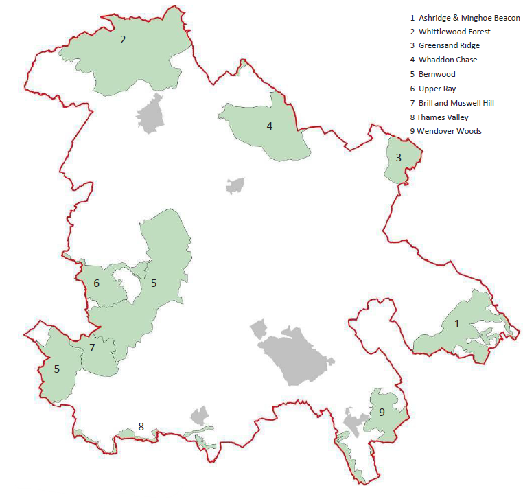
Figure 3.16: Biodiversity opportunity areas
3.4.6 Traditionally, nature conservation has focused on protecting important sites, however these sites are still fragmented and isolated from one another. Consideration is needed of functionally linked habitats - those areas beyond the boundary of a designated site which play an important role in maintaining the favourable conservation status of features and attributes for which a site was designated, for example by providing supporting habitats or regulating hydrological or nutrient cycles.
3.4.7 Certain habitats and species are protected by legislation, such as Great Crested Newts. Surveys show that Great Crested Newts are found in around a third of all ponds in Aylesbury Vale, higher than the national average. Natural England has granted Buckinghamshire Council a District Licence for Great Crested Newts as part of a regional conservation scheme. This is a streamlined process whereby developers do not need to commission newt surveys, as there has already been a wider regional assessment for the district licence. Developers need to apply to enter the district licensing scheme and present a district licence certificate or report (obtained through NatureSpace) to the Council as part of a planning application.
3.4.8 The Buckinghamshire and Milton Keynes Environmental Records Centre (BMERC) holds up to date records of designated sites, priority habitats and wildlife records. These records provide vital data to help inform decisions on development proposals and management of sites.
3.5 Settlement character
3.5.1 Aylesbury Vale has a distinctive settlement pattern of towns, villages and hamlets. Its largest settlements, Aylesbury and Buckingham are historic market towns serving a rural hinterland and with routes radiating from the centre. Many of the area's other settlements have grown around a road junction, or are linear in form with properties strung along one or both sides of a road. A large number of the settlements in Aylesbury Vale are historic and have conservation area designations.
3.5.2 Aylesbury Vale's distinctive and varied settlement form and character have also arisen from its history of development and the patterns and trends that have influenced it. Important factors include its agricultural history, such as parliamentary field enclosures and improved farmland, model villages and the influence of the Rothschild estate, and industrial development. Understanding these varied forms and the history which has created them is important when assessing the context and character of each place.
3.5.3 A settlement hierarchy is set out in Policy S3 of the Local Plan and this identifies six settlement categories. The settlement hierarchy is based on an assessment of population size, settlement connectivity, and the availability of employment and other services and facilities. Growth promoted in the Local Plan is distributed according to this hierarchy with the housing allocations generally greater in those settlements higher in the hierarchy where that development is more sustainable. The smaller settlements often have a close relationship with the surrounding countryside and this means that they are particularly sensitive to new development.
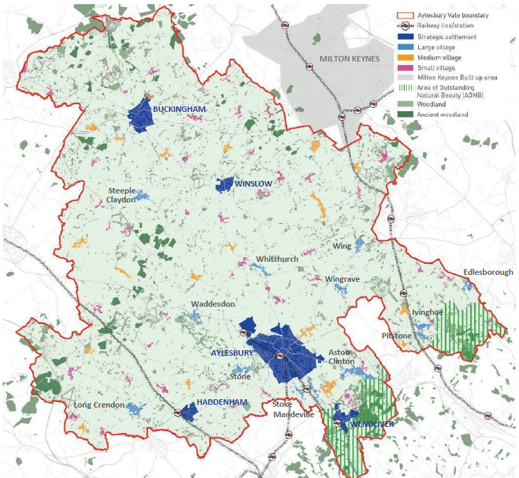
Figure 3.17: Aylesbury Vale settlements
SETTLEMENT CONTEXTS
3.5.4 The pattern of settlements gives rise to a number of broad character types across the area:
Principle DES4: Settlement and site context
Applicants should carry out a context appraisal that identifies the broad settlement context within which their site is located. This should form part of their character study and site appraisal (refer to Principles DES7 and DES8) and applicants must demonstrate how this has informed their development proposals.
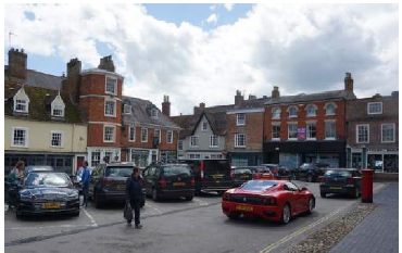
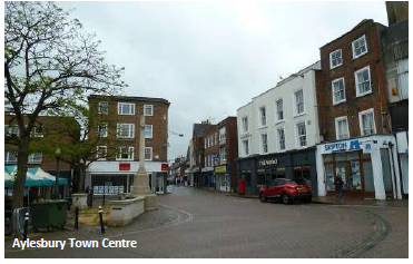
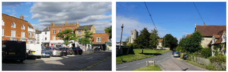
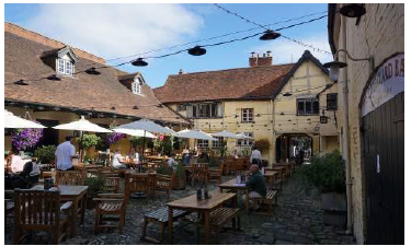
The urban context (fine grain)
3.5.5 The historic centre of many of Aylesbury Vale's settlements is characterised by a development pattern that is fine grain (i.e. composed of small scale development that has a predominantly vertical rhythm and which is characterised by tight street enclosure), and where a mix of uses provide activity and buildings tightly define a series of streets, squares, alleys and courts.
3.5.6 These areas are often rich in character and include historic buildings of heritage value and a high level of archaeological interest.
3.5.7 In some centres the fine grain development is mixed and includes development from a variety of historic periods including medieval, Georgian, Victorian and pre and post war buildings with shops, cafes and other active uses at the ground floor level. In these areas the quality of the built fabric varies and there may be scope for some modest change and intensification. However this would need to take into account the context and character of the area.
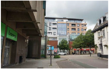
The urban context (coarse grain)
3.5.8 Aylesbury and Buckingham are also characterised by areas with a coarser grain with a less consistent built form. These areas include larger floorplate buildings of a greater scale and massing and a mix of uses including shopping centres, offices, food stores and apartment buildings.
3.5.9 The quality of the environment and the relationship of development to streets varies within these areas with buildings sometimes set within extensive surface car parks.
3.5.10 These areas may offer opportunity for change, intensification and improvement.
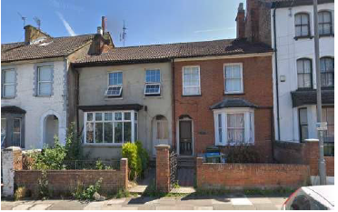
Victorian / Edwardian urban streets
3.5.11 The edge of some town and village centres features Victorian residential streets often as a legacy of the coming of the railway to the area in the 19th century.
3.5.12 Generally properties in these areas are two storey, brick built, of a modest scale (frontage typically 4-6m wide and 8m deep) and laid out as terraces set close to the footway behind a small garden / privacy strip which is often defined by a low brick wall and occasional boundary vegetation. Car parking is generally on street.
3.5.13 Victorian villas are less common in the area. These properties are larger, often semi-detached but again front onto streets behind a small garden.
3.5.14 Victorian / Edwardian streets are urban in character and laid out as part of a gridded structure of perimeter blocks and connected streets with medium densities of 30 to 50 dwellings per hectare.
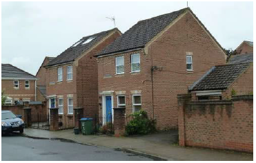
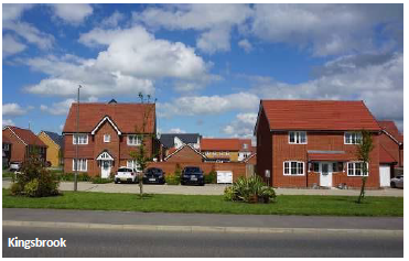
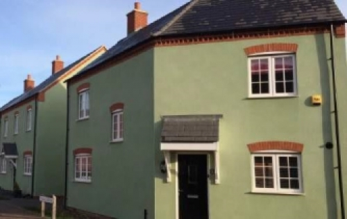
Suburban context
3.5.15 Much of 20th and 21st century development in Aylesbury Vale is suburban housing found in the towns and larger villages.
3.5.16 The character of these areas varies from place to place but many are laid out as a disconnected network of streets accessed off an estate road and often the streetscape is dominated by car hard standings and lacking street trees and garden vegetation. Whilst buildings usually front the streets, frontages are sometimes fragmented by gaps and buildings are often too loosely grouped, too far apart or of insufficient height to enclose the street space.
3.5.17 Suburban residential densities are normally between 20 and 35 dwellings per hectare.
Lower density suburban
3.5.18 The low-density areas are characterised by large residential properties set within often well-vegetated, generous plots. In these areas, the landscape and mature vegetation is an important component of the area's character. Residential densities within these areas are typically less than 20 dwellings per hectare.
3.5.19 This character type can be found towards the edge of the main towns and villages and largely originates from the post-war years through to the 1990s.
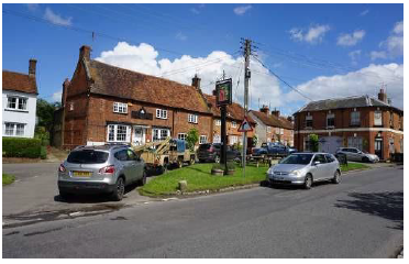
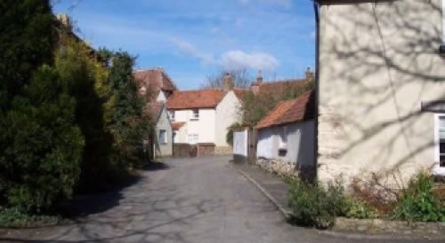
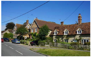
Traditional rural village context
3.5.20 Villages set within the wider countryside are often located at the intersection of routes (nucleated settlements e.g. Brill or Quainton) or extending along a route (linear settlements e.g. Stewkley and Grendon Underwood) and display both rural and urban qualities.
3.5.21 Buildings are tightly clustered to define space in key locations such as around nodes, main streets and defining important spaces (eg village greens) often with large scale mature trees.
3.5.22 The relationship of the dwellings to the landscape is important within these settlements with properties taking advantage of views to the open countryside and trees an important feature. Densities generally reduce towards the settlement edge.
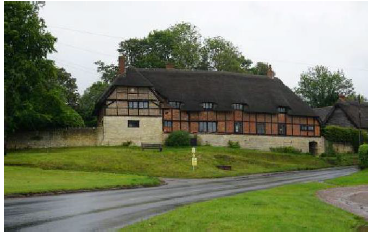
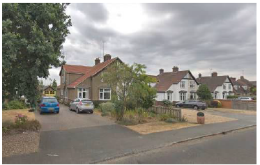
Rural dwellings hamlets and farmsteads
3.5.23 The countryside features isolated dwellings, country estates and small groups of dwellings such as hamlets and farm buildings. In these locations the surrounding landscape is the dominant feature.
3.5.24 Aylesbury Vale has retained a very good number of early large farmhouses. Some survive from the medieval period, though most appear to date from the sixteenth century. In common with much of the South East of England farm buildings arranged in loose courtyard plans is the predominant plan type for medium to large farmsteads.
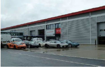
Industrial Estates / Business Parks
3.5.25 Within Aylesbury Vale there are a number of industrial estates and business parks often based on former clusters of agricultural buildings. These present a different urban condition where large floor-plate sheds set within yards and served by estate roads predominate. They provide an important part of the local economy but often present a poor quality pedestrian environment that is unattractive to move through and when located within open countryside can have significant visual impact.
3.5.26 These estates may present opportunity for redevelopment to deliver more attractive and efficient layouts where the employment uses interface better with adjacent residential neighbourhoods or the wider landscape and where there is potential to improve the quality of the pedestrian environment and experience.
3.6 Aylesbury Garden Town
3.6.1 Aylesbury is by some way the largest settlement within Aylesbury Vale and the County Town of Buckinghamshire with a resident population of 71,500 (2011 Census). With its origins as a Saxon settlement it became an administrative centre for the wider area in medieval times with its market serving as a focal point. Aylesbury grew through the 19th century with the coming of the railway and Grand Union Canal. However the population of the town was still under 10,000 at the beginning of the 20th century.
3.6.2 Aylesbury was designated as a London overspill town in the 1950s and grew at a rapid rate, expanding along radial routes and then ringing the town with residential suburbs, most recently at Berryfields and Kingsbrook.
3.6.3 Aylesbury was awarded Garden Town status by the Government in January 2017 as part of a wider programme of Garden Communities. The programme seeks to evoke a number of principles that were prevalent in the British Garden Cities movement a century ago and that led to places such as Welwyn and Letchworth Garden Cities and inspired the new towns of the mid-20th century.
3.6.4 This 21st century programme has been informed by work undertaken by the Town and Country Planning Association (TCPA) over the past decade.
3.6.5 This is articulated in their "Garden City Principles" which set a framework that new communities should accord to.
Garden City Principles (TCPA)
“A Garden City is a holistically planned new settlement which enhances the natural environment and offers highquality affordable housing and locally accessible work in beautiful, healthy and sociable communities. The Garden City Principles are an indivisible and interlocking framework for their delivery, and include:
- Land value capture for the benefit of the community
- Strong vision, leadership and community engagement
- Community ownership of land and long-term stewardship of assets
- Mixed-tenure homes and housing types that are genuinely affordable
- A wide range of local jobs in the Garden City within easy commuting distance of homes
- Beautifully and imaginatively designed homes with gardens, combining the best of town and country to create healthy communities, and including opportunities to grow food
- Development that enhances the natural environment, providing a comprehensive green infrastructure network and net biodiversity gains, and that uses zero-carbon and energy-positive technology to ensure climate resilience
- Strong cultural, recreational and shopping facilities in walkable, vibrant, sociable neighbourhoods
- Integrated and accessible transport systems, with walking, cycling and public transport designed to be the most attractive forms of local transport”
Figure 3.18: Garden City Principles - Town and Country Planning Association (TCPA)
VALP Policy reference: D1
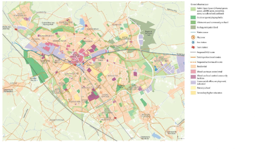
Figure 3.19: Aylesbury Garden Town Plan
3.6.6 The Aylesbury Garden Town (AGT) will be the focus for the majority of the area's growth. Over 16,000 new homes, together with significant new employment space, is proposed with the majority to be delivered on six large allocated sites at the edge of the built up area.
3.6.7 VALP Policy D1 principle (a) requires development in the AGT to create "distinctive, inclusive sustainable, highquality,successfulnewcommunitieswhichsupport and enhance existing communities with the highest quality, planning, design and management of the built and public realm".
Principle DES5: Aylesbury Garden Town
Applicants with sites within Aylesbury Garden Town must familiarise themselves with the vision and design principles set out in the Aylesbury Garden Town masterplan and ensure that their development proposals are designed in accordance with both the recommendations within that document and this Design SPD.
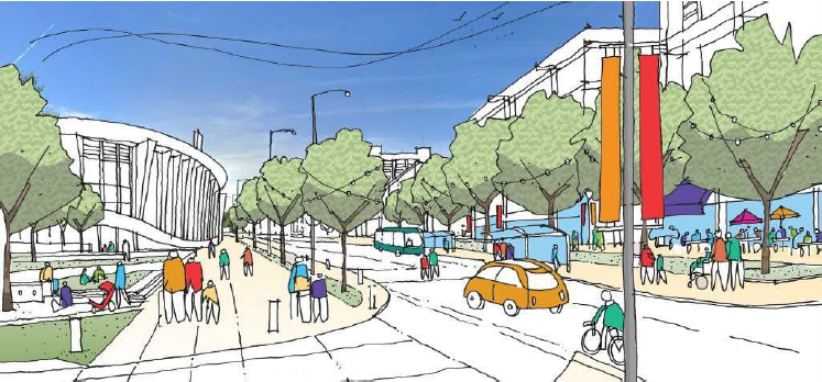
Figure 3.20: Indicative Image - Exchange Street, Aylesbury with enhanced public realm and new buildings providing frontage to streets (Credit: Alan Baxter Ltd / Prior and Partners)
3.6.8 The vision for the Aylesbury Garden Town (AGT) is set out in the AGT Masterplan. It focuses on the whole town in an holistic way to ensure that:
- Aylesbury town centre will be a thriving civic and commercial heart and a destination for exchange, commerce and leisure;
- Local and neighbourhood centre and community facilities are available for everyone and support the highest quality of life;
- A web of green and blue infrastructure provides the 'garden' in Garden Town;
- People choose to walk, cycle or use public transport for everyday journeys and that streets are people friendly places no longer dominated by traffic;
- The garden communities will provide varied and beautiful neighbourhoods each with a distinctive design and character and that Aylesbury will be a showcase for new approaches to housing and delivery;
- Aylesbury will be a competitive place to do business and a core component of the Oxford to Cambridge corridor well connected to London and the Thames Valley; and
- Integration of smart and low carbon technologies will create a more resilient and sustainable place.
3.6.9 The AGT Masterplan identifies the provision of a "connected network of multi functional blue and green infrastructure" as being central to the identity of Aylesbury as a Garden Town and recognises the role of green infrastructure within the urban environment in contributing to the 'Garden Town' character through provision of "leafy streets, plentiful outside space and a high quality public realm".
3.6.10 Further details about the Aylesbury Gardens Town site allocations and the design and delivery principles are set out in Policy D1 and the relevant site policies in VALP. Additional site specific guidance is provided in the AGT masterplan. Go to council website
3.7 Local vernacular and distinctiveness
3.7.1 Local distinctiveness is the essence of what makes a place special, differentiating it from anywhere else. It is the sum of cultural and non-cultural landscape, wildlife, archaeology, history, traditions and events, ambience, dialects, buildings and crafts – everything that makes somewhere truly unique. It is also connected with people's memory of a place.
3.7.2 New developments within Aylesbury Vale should reflect local distinctiveness to reinforce the area's unique sense of place, particularly in terms of layouts and how they respond to landscape and topography, design of new buildings, use of materials, colours and textures. Understanding local distinctiveness applies to all development, whether new build, alteration, extension, repair or minor change and to all categories of development: industrial, commercial or residential.
'Local Distinctiveness is concerned with celebrating the unique characteristics of a place and with demanding the best of the new, so that quality and authenticity adds richness to our surroundings making them convivial to us and to nature.'
Common Ground, 1985
Principle DES6: Responding to local vernacular and distinctiveness
Local distinctiveness and identity forms part of the character of a place. Applicants will be required to demonstrate what makes the application site locally distinctive through survey and analysis, and how this has informed the design process and development proposals.
Settlement structure and built character
3.7.3 The grain and layout of the site or area, its scale and density and its built form are key aspects of its distinctiveness which should be explored and understood before making any changes. Within the broader pattern of settlement form and structure, the form of individual buildings reflects local building traditions, changing technologies and building functions, use of materials, and historical economic and social status.
3.7.4 Researching the history and development of the place, which have created these forms, creates better- informed development with a deeper understanding of its context (refer to Section 3.5 Settlement character).
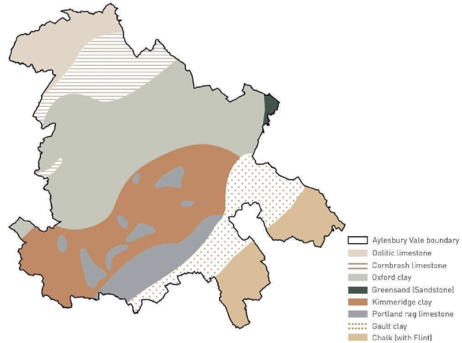
Figure 3.21: Aylesbury Vale underlying geology
Geology and materials
3.7.5 Geology and landform make a distinct contribution to the landscape character of Aylesbury Vale and through the materials used within the settlements and landscapes of the Vale (refer to Figure 3.21).
3.7.6 Historically, the use of particular materials was localised, determined by availability and limited by the difficulty or the expense of transportation. Over the years, many individual settlements achieved an association with locally derived materials, which provide a distinct identity. The use of local materials gives a sense of place, continuity and permanence, which can assist in integrating new development into its surroundings.
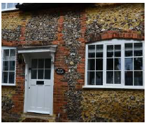
Left: Clay tiles are a feature on roofs in the Vale, Right: Traditional cottage with flint walls and brick details
Local materials
Traditional limestone buildings
3.7.7 The materials used in a development are important as they contribute to the overall appearance, can maintain and enhance local identity and connection to the surrounding landscape and enhance the character of a location.
Brick
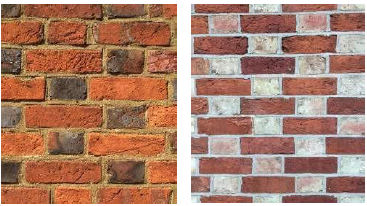
Historic Flemish bond predominates throughout the area where bricks are used, with variations in brick and mortar colour, such as in Buckingham and Winslow
3.7.8 Between the limestone hills lie the clay vales where brick is the predominant building material. The texture, size and hue of these bricks varies throughout, especially where historically, bricks were manufactured locally and by hand. Before the mass production of bricks in the middle of the 19th century, there was no 'industry standard' for bricks resulting in differences depending on local clays, preferences and set up of local craftsman.
3.7.9 Bricks are the most widespread traditional building materials in Aylesbury Vale. Typically characteristic bricks are locally derived, relatively smooth faced and warm coloured, red-orange and red-brown. Parts of the Vale are still strongly associated with brick such as Brill, Hardwick, Whitchurch and Waddesdon. Brickyards in the Quainton / Westcott and Pitstone area produced a distinctive light yellow (Gault Clay) brick found in domestic buildings nearby.
3.7.10 There are many types of brick bonding used throughout the area and these will need to be considered when proposing new developments, paricularly where alterations to existing buildings are planned. The type of bond enhances the overall appearance of buildings by adding texture and natural variations in colour.
3.7.11 Lime mortar is often used in historic buildings and can either complement or contrast with the colour and texture of the bricks being used. The use of lime mortar creates a traditional appearance but also has important physical properties, such as its porosity, which need to be taken into account. The use of the wrong mortar can cause rapid deterioration of historic brick and stone, resulting in a loss of authentic historic fabric and ultimately local character.
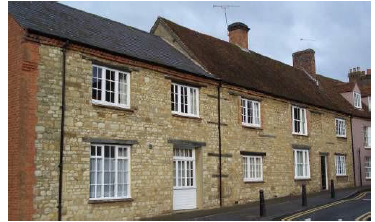
Stone
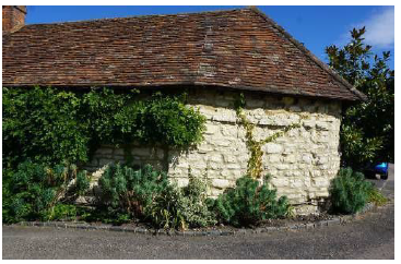
3.7.12 Between the foot of the Chilterns escarpment and the dip slope of the Cotswolds rise a series of low limestone hills. These upland areas can be found in three distinct groups, the plateau north of Buckingham in the north west part of the District, the Brill-Winchendon hills, and the Quainton-Wing hills. Within these areas limestone is the predominant building material, particularly in villages such as Turweston, Shalstone, Oving and Thornborough. The exception are villages such as Brill that are predominantly red brick. Throughout these areas, lime mortar and red brick are combined.
Witchert
Witchert building in Haddenham
3.7.13 Witchert is a naturally occurring mixture of clay and chalk which, when mixed with chopped straw and water, achieves a malleable substance and can be built up in layers (or rises) on a stone or rubble footing (grumpling) as a building material. Witchert is found in the vicinity of Dinton, Lower Winchendon, Haddenham, Long Crendon, Chearsley and Cuddington, as far north as Ludgershall and as far east as Bierton.
3.7.14 Witchert is susceptible to erosion and weather protection is provided by copings and a lime plaster or lime wash over vertical surfaces. Originally, witchert walls were thatched and some have old plain tile copings, with pantiles being a later tradition.
Timber
3.7.15 Wide timber boards are a traditional cladding feature used on barns and outbuildings, typically with a black colouration. They provide an excellent means of reducing the visual impact of garages and other ancillary structures.
Flint
3.7.16 Flint from the Chilterns and the area west of Wendover is linked with the construction of buildings and boundary walls. 19th century farm buildings and churches frequently used flint with brick dressing and lime mortar. Both knapped and cobbled forms of flint construction are found within this part of the area.
Render
3.7.17 Strong, but subdued shades, off coloured lime-wash (white or cream) is commonly used in rendered buildings which are found in many settlements across the area. Inappropriate use of modern paints has a negative impact on character and physical properties of render, resulting in damp issues and loss of historic fabric.
Roofs
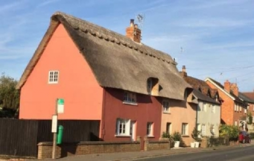
Varied roof pitches and materials, including thatch, tiles and harmonious coloured lime washed render
3.7.18 Roof shape, pitch and materials contribute to local identity. In Aylesbury Vale, the use of steep dual pitched roofs in clay plain tiles is seen on both old and recent buildings. Slate and clay pantiles are also widespread roof materials. There are a considerable number of thatched buildings throughout the area, with long straw material being the most traditional thatch type to the area.
3.7.19 Materials used for roofs are associated with different roof pitches. Thatch is rarely laid under a 50 degree pitch, slate is normally laid between 20- 35 degrees, clay plain tiles are generally laid between 40- 60 degrees and pantiles are usually laid at about 40 degrees.
3.7.20 Plain clay tiles are typically used on pitched roofs in the area, with slate tiles associated with re-roofing post the arrival of the railways or with Victorian development. Natural slate tiles are often seen combined with yellow bricks, plain or coloured render. Where roofs are hipped, bonnet tiles create a complete and harmonious appearance to the roof.
Modern materials
Modern development using pale coloured render
3.7.21 There are examples of commercial and industrial buildings in the area that owe their success largely to the skilful use of modern materials. New products should, however, be robust and capable of ageing and weathering in an attractive way.
3.7.22 In areas where there is a historic context, such as conservation areas, modern materials are often less satisfactory unless selected to complement, or otherwise be compatible with, existing traditional building materials, particularly those which give local character or identity. All proposed materials, whether traditional or modern, should be carefully selected using the Character Study and Site Appraisal to make informed choices, suitable for their specific location.
3.8 Character study
3.8.1 The council will normally require a Character Study to be prepared to support any development proposal requiring a Design and Access Statement, irrespective of scale. The objective of the Character Study is to identify, analyse and describe in a systematic and objective way, those elements, or combination of elements, that have a positive role in helping to form the character of a place. Elements may be drawn from the immediate surroundings or (where relevant) from adjacent settlements or landscapes within Aylesbury Vale, taking care to focus on the traditional elements rather than inappropriate modern development.
3.8.2 The Character Study would form part of the Design and Access Statement submitted as part of an application.
3.8.3 The level of detail in the study should be related to the scale of the development proposals. For example:
- A proposal for an urban extension should be supported by a comprehensive study to consider the extension in the context of the existing settlement, its location in the wider landscape and its movement and green space network, carefully considering how the development would integrate with and enhance the settlement;
- An application for infill development or single dwelling may just consider the character of the street and the neighbouring properties to inform how the development can successfully complement the streetscene; and
- For sites located in areas where it may not be desirable to replicate or respond to the immediate character, applicants should consider adjacent areas or settlements and draw from those elements which help make Aylesbury Vale a distinctive place.
3.8.4 The checklists at the end of Chapter 3 provide guidance on the appropriate scope and subject areas for the Character Study depending on the scale of the proposed development.
Principle DES7: Character Study
Applicants should prepare a Character Study that identifies the context within which the application site is set. This should consider the structure and history of the settlement within which it is located or relates, the character of the landscape, the positive features within the streets and spaces and the built form.
The Character Study will help to guide and inform the proposals that are prepared later in the design process and applicants will be required to demonstrate how the study informs the design proposals.
The Character Study should identify the existing characteristics that can help to reinforce local identity and/or create a defined sense of place.
The Character Study will form part of the Design and Access Statement that supports a planning application.
3.9 Site appraisal
3.9.1 Having identified planning designations relevant to their site and prepared a Character Study, applicants should then carry out and a detailed Site Appraisal to consider the physical aspects of their site, including topography, drainage, existing natural features, and access points in order to identify the key constraints and opportunities that may impact on future development. This Site Appraisal would form part of the Design and Access Statement submitted as part of an application.
3.9.2 The objective of this Site Appraisal is to identify, in spatial terms, those constraints that will influence the design and the opportunities afforded by the site.
3.9.3 The scope and areas covered in the Site Appraisal should be related to the scale of the development proposals.
3.9.4 The checklist at the end of the Chapter provides guidance on the appropriate scope and subject areas for the Site Appraisal. This should not be considered as an exhaustive list of the constraints and opportunities but rather a starting point for consideration.
Principle DES8: Site Appraisal
Applicants should carry out a Site Appraisal that identifies and illustrates the physical aspects of their site and identifies key constraints and opportunities that will help to inform their proposal.
The Site Appraisal will form part of the Design and Access Statement that supports a planning application (including outline, full or reserved matters applications) and will include proposal drawings, supporting text and illustrations that demonstrate that the site appraisal has been comprehensively undertaken.
Potential constraints and opportunities for consideration as part of the Site Appraisal
This is not an exhaustive list but a starting point for consideration:
- Topography and views;
- Geology, ground conditions / contaminated land;
- Site orientation and microclimate;
- Air quality and noise;
- Drainage, hydrology and flood risk;
- The location and capacity of existing services;
- The history and heritage of the site and the potential for significant archaeological artefacts;
- Adjacent land uses and sensitivities including adjacent dwellings that may impact site potential or overlook the site;
- Existing landscape features (including trees) that are of value;
- Trees and vegetation covered by Tree Preservation Orders (TPO's), conservation areas, or Hedgerow Regulations;
- Habitats, protected species and any features that contribute to biodiversity / potential to achieve net gain in biodiversity;
- Site access by all modes of transport; and
- Rights of way or opportunities to connect and integrate with the existing development pattern.
Refer also to the Checklist at the end of Chapter 3.
How to use
This table provides a checklist of things to consider when preparing a Character Study. The checklist should be used by applicants and planning officers as prompts when preparing the Character Study.
|
SUBJECT |
DESCRIPTION |
CONSIDERATION |
CHECK |
|
Wider setting |
What is the wider setting of the site and the location of the settlement in relation to other settlements within the region? |
Function of the settlement and relationship to adjacent areas |
|
|
What is the wider context within which the site is located? |
Settlement + site context (Principle DES4) |
||
|
Settlement structure |
How is the settlement within which the site is located structured and laid out and where does it connect to? Does it have a linear structure along a main route or is part of a grid of streets for example? |
Historical development and layout |
|
|
What is the existing hierarchy and network of streets and spaces within the settlement and how does this contribute to its character? |
Structure and hierarchy of streets and spaces |
||
|
Are there any places or uses that provide a focus for the settlement? |
Identity |
||
|
What is the prevailing density of the settlement? Does it vary and what would be appropriate for the application site or for different parts of the site? |
Density of development |
||
|
How does the existing settlement mark arrival points or the meeting of routes? Can this be drawn upon to mark gateways and nodes within the proposal? |
Gateways and nodes |
||
|
How large are existing plots or blocks within the settlement? Is the pattern regular or irregular? |
Plot and block size |
||
|
Landscape character/ natural features/ topography |
What is the landscape character, underlying geology and landform and how might this influence the development? Are there particular landscape, arboricultural, ecological or geological characteristics that give a place its essential character? |
Landscape and settlement character (Principle DES2 and DES4) |
|
|
Are there landscape features (trees, hedgerows, ecological or geological), within the site that give the place its character and how can these be incorporated into the proposals? |
Existing landscape features, water features, trees, hedges |
||
|
Are there any important views to and from the site and beyond that are valuable and should be retained? Understanding how the new development will be perceived from the surrounding area. |
Views and skyline |
||
|
Streets and public spaces |
What is the prevailing level of enclosure for existing street types within the settlement? Does this contribute to their character? How are spaces enclosed? |
The containment of streets and public open spaces |
|
|
Are there particular public realm characteristics, such as planting, form, materials to draw influence from? |
Layout and form of spaces |
||
|
How does the interface between private and public spaces contribute to the settlement's character? |
Public and private space interface |
||
|
How does public art contribute to the settlement's character? |
Public art |
||
|
Built character |
What is the local built character and form (both plan and 3 dimensionally) and building uses and how do buildings relate to each other. How does this provide cues for appropriate design forms? |
Scale, form and massing and building use (Principle DES6) |
|
|
Does the building frontage define the public realm or are there front gardens? What are the prevailing boundary treatments? |
Treatment of building frontages and boundaries (Principle DES6) |
||
|
Are there common building types prevalent within the settlement? Can these be re-interpreted? |
Building types (Principle DES6) |
||
|
Are there common building materials within the settlement which would be relevant to the proposal? |
Use of materials (Principle DES6) |
This table provides a checklist of things to consider when preparing a Site Appraisal. The checklist should be used by applicants and planning officers as prompts to identify Constraints and Opportunities for all sites.
|
SUBJECT |
COMPONENT |
SITE APPRAISAL |
CHECK |
|
Physical Environment |
Topography and views |
What is the topography of the site and how will this influence the proposals? How is the site viewed or overlooked from afar? Are there prominent overlooked areas that may be best left undeveloped? How can the development provide a well-defined external image to the countryside? |
|
|
Geology, ground conditions and contaminated land |
What is the existing geology of the site? Are there areas of the site which are difficult to build on, contaminated or potentially contaminated or less porous than others? |
||
|
Orientation and microclimate |
How is the site orientated? Can this be capitalised on? |
||
|
Air quality, noise |
Are there areas of the site which are affected by noise or poor air quality such as adjacent to major strategic roads or rail infrastructure or existing cultural or community buildings? Are there areas of the site which are within or near an Air Quality Management Area? |
||
|
Drainage and hydrology |
How does the site currently drain? Are there locations where water collects? Are soils permeable? How will this affect the proposals and the potential for sustainable drainage systems? |
||
|
Flooding |
Are there areas of the site within the flood plain? Are there areas of the site prone to fluvial, surface water and/ or groundwater flooding? |
||
|
Services |
Are there existing services and/or capacity to serve the development? Are there any existing utilities or service infrastructure that may constrain your development. For instance overhead power lines or a significant sewer. |
||
|
Heritage |
Designated and non- designated heritage assets |
Are there any listed buildings, conservation areas, scheduled monuments on site or is the site in the setting of any of these heritage assets? Are there likely to be any archeological remains within the area? Are there any non- designated assets on or adjacent to site? Is the site located within the setting of a designated or non-designated heritage asset? Are any studies required? |
|
|
Landscape |
Trees and vegetation |
Are there any trees on or adjacent to the site with Tree Preservation Orders? Is the site located in a conservation area? Are there any hedgerows that could be protected under the Hedgerow Regulations? Has a tree survey to BS5837:2012 (or most recent equivalent) been carried out? |
|
|
Existing features |
Are there any existing features such as trees, hedgerows, watercourses, or areas of woodland that contribute to the sites amenity value and should be retained? |
||
|
Ecology and biodiversity |
Priority habitats and species |
What is the existing biodiversity value of the site? Are there particular areas or features which have a high biodiversity value that should be protected? Is there opportunity for habitat creation and enhancement? |
|
|
Highways |
Site access by all modes |
What are the existing access arrangements for the site? Does an alternative means of access have to be introduced? |
|
|
Connections and Links |
Are there existing rights of way across the site? Can the site connect back to an existing neighbourhood and be integrated with an existing street network? What existing cycle infrastructure is there? Can a footpath be upgraded to bridleway to accommodate cycling access? |
This table provides a checklist for use by both the applicant and planning officer to check that appropriate consideration has been given to how an application responds to its setting.
PROCESS: Have you:
- Identified all planning designations;
- Considered the character of the site within its settlement and prepared a Character Study; and
- Carried out a detailed Site Appraisal and established the constraints and opportunities that apply to the site.
The adjacent table summarises the key principles set out within this section and can be used by both the applicant and officer.
Applicants will be expected to demonstrate to the council that they have responding adequately to all relevant principles in preparing their proposals.
|
PRINCIPLE |
DESCRIPTION |
CHECK |
|
DES1: Designations |
Has the applicant clearly identified whether the site lies within or adjacent to any area with a statutory or non-statutory planning designation? |
|
|
Has the applicant understood the implications of these designations on the development of the site? |
||
|
DES2: Landscape Character |
Has the applicant carried out an evaluation of the landscape character of their site and its setting? |
|
|
DES3: Ecology |
Has the applicant identified whether priority habitats or protected species lie within or adjacent to the site? |
|
|
Has the applicant demonstrated how the development design will protect, enhance, create and connect biodiversity to support coherent and resilient ecological networks? |
||
|
Has the applicant identified the opportunities for new development to achieve biodiversity net gain following the mitigation hierarchy? |
||
|
DES4: Settlement and site context |
Has the applicant identified the potential opportunities for new development to make a positive contribution to the character of a settlement? |
|
|
DES5: Aylesbury GardenTown |
Is the site within the Aylesbury Garden Town? Has the applicant understood the AGT vision and principles that also apply to their proposals? |
|
|
DES6: Responding to local vernacular and distinctiveness |
Has the applicant identified the local vernacular and the characteristics that makes the area within which the site is located distinctive? |
|
|
DES7: Character Study |
Has the applicant carried out a Character Study and covered the topics set out in the relevant checklist? |
|
|
DES8: Site Appraisal |
Has the applicant prepared a detailed Site Appraisal and identified the constraints and opportunities that apply to their site? |
SUMMARY:
At this stage the applicant should have a full understanding of their site and its context. This work should be undertaken before developing design proposals.


