Shenley Park SPD
Part Four: Framework Plan
The Framework Plan for Shenley Park brings together identified site characteristics and key structuring design principles into a comprehensive spatial development framework for the allocated site against which development and infrastructure proposals can be assessed.
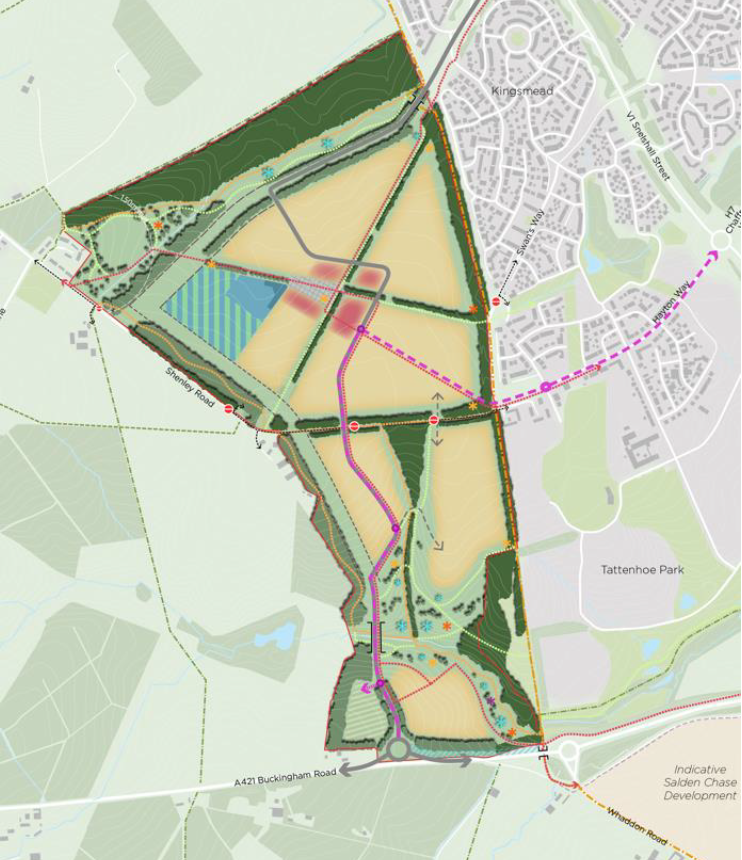
Figure 7: Framework Plan
|
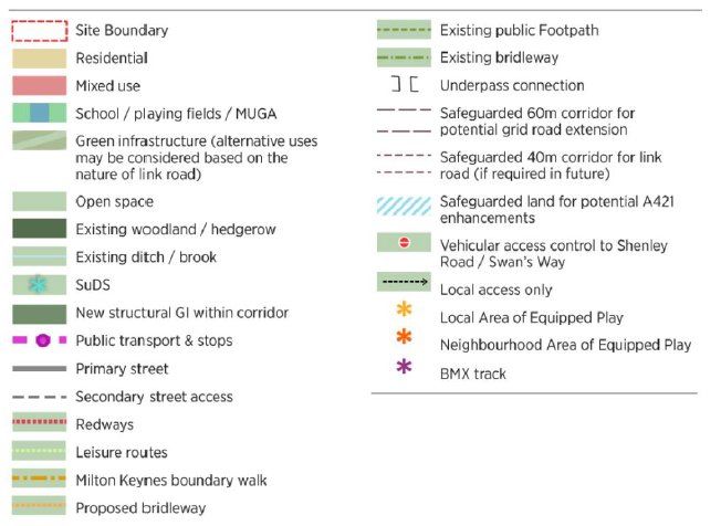
Shenley Park (Total Site Area) |
c. 99 ha |
|
Green Infrastructure incl. infrastructure reserve |
c. 57 ha |
|
2FE Primary School, drop off area and Playing Fields |
c. 4 ha |
|
Mixed use including 110 bed Care Home |
c. 1.5 ha |
|
Development Area (Residential) |
c. 33.5 ha |
|
Primary Infrastructure |
c. 3 ha |
Key for Figure 7
Indicative areas (built development and infrastructure, rounded) as shown on the Framework Plan (Figure 7)
The site analysis undertaken as part of the Baseline Report has highlighted the site's topographical character as a key defining element. The northern half, being generally flat, is able to accommodate built form with less sensitivity in terms of impact on landscape and adjacent uses whereas the southern half comprises of valleys and slopes and is more sensitive to development. The application of the key structuring elements generates an outline framework for the split of developable land and green infrastructure.
The Site is designed as, and should be viewed as, a single neighbourhood but with clearly different design responses. The form and character of development should respect the characteristics of the site and deliver distinctive development and high quality placemaking outcomes. This is explained further in Part Six: Placemaking
4.1 Extent of Development and Land Uses
The sub-sections below set out the key principles for development under the following headings:
- Housing Mix,
- Local Centre;
- School and Sports Pitches;
- North and Western Edges;
- South-western parcel;
- Development Extent;
- Density of Built Form.
Further design guidance in relation to the local centre and edge responses are provided at Section 7 of the SPD.
Housing Mix
Housing provision (type, mix and tenure), including the care home/extra care facility, will need to comply with the standards set out in VALP policies H6a/H6b (and respective supporting text) to meet local housing need and to create socially-diverse and inclusive communities.
The intensity of development will vary across the site in response to site characteristics, context and sensitivities and will contribute to Shenley Park's placemaking qualities, legibility and character. A range of dwelling types and tenures will be provided for across the site, including a minimum of 25% affordable homes which will be 'pepper potted' across the site. Dwellings will be designed to be flexible and adaptable to respond to the changes in how we use space in our homes such as for working from home, and will therefore be capable of meeting a wide range of needs, and will include self or custom build (see VALP policy H5) and forms of specialist residential accommodation.
Local Centre
The northern half of the site is the most suitable location to accommodate the required local centre and creating a focal point for the development. In this position, it complements the relative positioning of the existing (and proposed) nearby local and district centres located in adjacent developments (see Baseline Report Annex 1). The Shenley Park local centre will be of a scale that will aim to provide sufficient goods, facilities and services to meet residents' day-to-day needs without creating competition with existing centres. Extensive walking and cycling connections extending across and through the site will create 'walkable neighbourhoods' meaning that the local centre will be easily accessed from all parts of the site, reducing the need to drive. Its position in the northern half also means that residents of Whaddon village will have easy access to benefit from the new amenities and facilities in the development, and connecting the two communities.
Section 7 of the SPD under 'key spaces and places' includes a sketch option for the arrangement of the Local Centre. It indicates a central cluster of services around 'Shenley Square', with the potential to provide public realm with open space at its heart and a mix of uses including community facilities, foodstore/local retail and the policy-mandated care home. This will create a vibrant, local centre and annex 6 to the Baseline Report includes a series of precedent studies and best practice examples as design references for each of the components. A mix of uses is envisaged but the composition is not prescribed in the SPD, in order to retain flexibility and ensure that the centre can respond to market demand and consumer requirements.
Flexibility in the masterplanning of the local centre means that provision can be made on site for primary health care facilities if required. Further discussions with Buckinghamshire and Milton Keynes Integrated Care Boards would be required at the time of any application to confirm if this is required or the extent of off-site contribution required. Similarly, discussions will need to take place with Bucks and Milton Keynes Health Trust to secure appropriate and proportionate offsite contributions to reflect the reality that the population are likely to use a mixture of health care facilities in both areas.
There is also the opportunity to integrate residential uses into the local centre as part of the mix of uses within buildings.
The local centre will be an area of higher intensity of development and where there is an opportunity to integrate residential uses into the local centre whereas areas of development fronting the linear park or on steeper gradients will be of a lower intensity. The use of varying intensities of development across the site could provide an increase in capacity of homes on the site and this would be appropriate in instances where densities can reinforce and support walkability within the neighbourhood and provide sufficient demand to promote sustainable travel options.
School and Sports Pitches
The new 2FE primary school and associated nursery, with opportunities for co-located sports pitches, are situated in an adjacent parcel to the west of the local centre in close proximity to the proposed Shenley Square bus stop and with the main school building and entrance intended to be located where it can be easily accessible (as shown in the indicative sketch included at Section 7 of the SPD). The school, in this location will also be easily accessed from all parts of the site, via the extensive walking and cycling connections extending across the site.
The primary school should be open at the point in which admissions into reception year from the development reaches 15 pupils in line with adopted Buckinghamshire Council guidance and which is sufficient to justify the opening of a new school balanced against the environmental and financial cost of transporting pupils to neighbouring schools. This is estimated to be upon occupation of the 350th home or four years from the commencement of development, whichever is the earlier. It is anticipated that offsite contributions will be secured (at timing trigger points to be agreed) for secondary school provision and to provide for any further primary school capacity which cannot be accommodated by the 2FE on-site school, taking into account capacity in the primary schools in the surrounding catchment areas.
School playing fields and formal sports pitches are shown provided adjacent to the school building but towards the outer edge of the northern parcel helping to retain the openness of the site towards the more sensitive countryside edges and which are intended to also be accessible for community use.
North and Western Edges
The treatment of the northern edge will provide for the required buffer offsets to the ancient woodland but also provide for an appropriate and substantial buffer between built development and the village of Whaddon as required by policy. The western edge treatment will also comprise of new and existing woodland and green infrastructure to form a defensible edge to the site as also stipulated by policy. The nature and character of the buffer and edge treatment is provided in more detail in later sections of this SPD.
South West Parcel
Due to topographical constraints and highway design requirements, the Framework Plan shows a parcel of land lying west of the point of access which is shown as green infrastructure. The southwestern-most parcel, located between the A421 junction improvements and the P&R facility, is not considered to be suitable for residential use due to concerns relating to its size and isolation from other residential parcels. There may be scope for non-residential land uses such as small scale employment uses to take place on this parcel as an alternative to residential development, albeit that acceptability of any non-residential use would depend on local/commercial demand, assessment against policy, and consideration of the relationship of this parcel with the landscaped edge and wider residential neighbourhoods at Shenley Park.
Development Extent
As part of the baseline evidence, the development extent and capacity of the site for the quantum of residential and other land uses allocated in policy WHA001 has been tested based on the constraints and analysis undertaken to date (see Baseline Report Annex 7). This includes the position established through the CHIA process that the archaeological remains are not required to be preserved in situ (see Baseline Report for further explanation).
The table accompanying Figure 7 above provides an indication of the quantum of land uses anticipated for the site, taking into account ANGSt compliant green infrastructure requirements together with other infrastructure and facilities to be provided within Shenley Park.
The Framework Plan and indicative land use budget generates an extent of built development (residential development and mixed use areas) of around 35ha. Whilst the full extent of site constraints (and any further consequence for developable area and layout) will not be fully known until such time as an application is determined, based on the level of information and evidence available through the Local Plan and the SPD process it can be confirmed that, assuming overall average densities between 30 and 40 dwellings per hectare, the allocated Site is capable of delivering the quantum of development set out in policy WHA001.
The ultimate level of development delivered in Shenley Park will be based on the approach set out in this SPD taking account of the adjacent settlement character and identity whilst responding positively to the best characteristics of the surrounding area along with technical evidence as appropriate, through a future planning application.
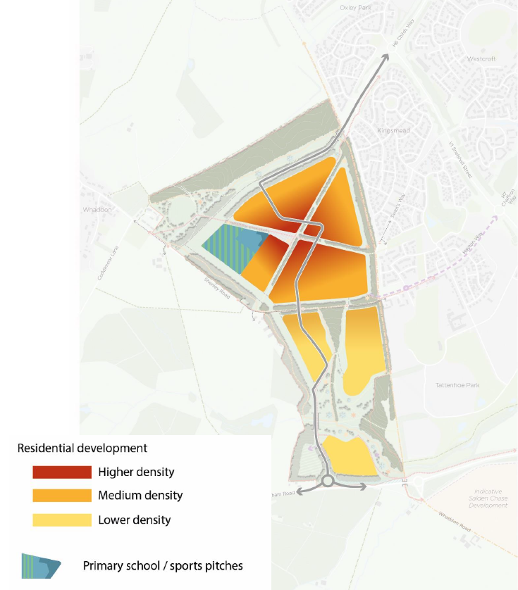
Figure 8: Density of development across the site (and key)
Density of Built Form
The SPD is not prescriptive about specific densities expected within various part of the site – development layouts and housing mix should be driven by placemaking and design character and by making efficient use of the land rather than fixing density requirements (see VALP policy BE4 and principle DES23 of the AVA Design SPD). However, the following design guidance and approach set out in Figure 8 should be adhered to in the formulation of development proposals and application plans:
- Higher density development would be acceptable in the northern parts of the Site (a) as part of/around the local centre, and (b) adjacent to the eastern boundary of the allocation, reflecting the character of adjacent built development. This should be generally restricted to three storey development to maintain a place-appropriate design response, albeit that there may be a design case to be made at application stage for bespoke design features to exceed this height as part of the design of landmark buildings at key corners and termination of vistas.
- The need for more bespoke design responses reflecting the topography and landscape constraints in the southern half of the Site and retaining a sense of space around buildings are likely to generate lower densities. Development layouts are expected to follow the contours of the site and respond positively to their landscape context, including frontages and active overlooking of open spaces, landscape corridors and the linear park extension;
- The full complement of open space requirements and other supporting uses will be accommodated on site in line with VALP policy.
Further testing on the impact on the highway network, landscape and visual impact, placemaking and design justification and other technical considerations would be required to accompany any application proposals which, having taken into account the design considerations above, propose dwelling numbers in excess of that set out in Policy WHA001.
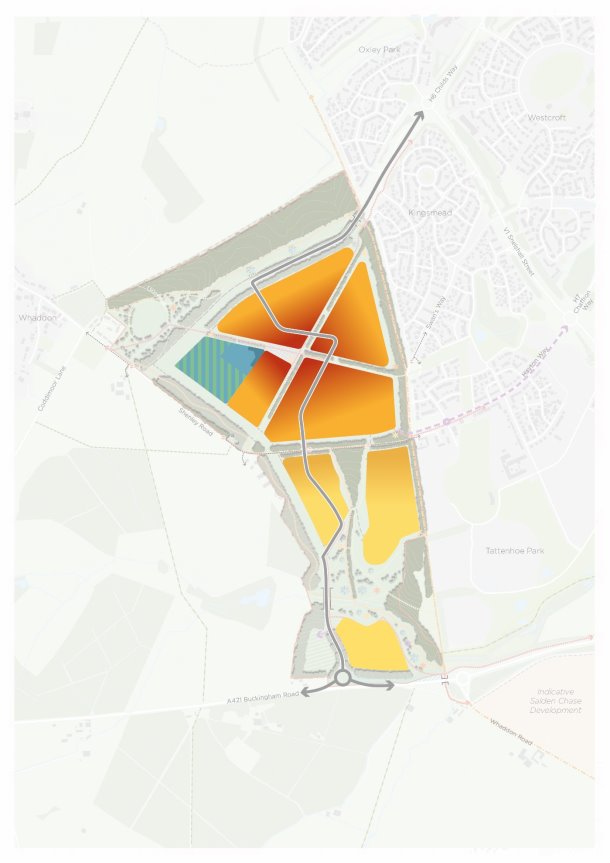
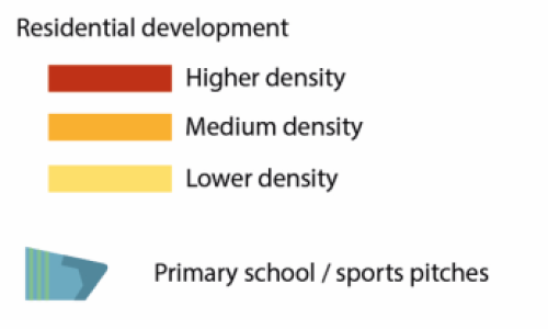
Figure 8: Density of development across the site (and key)


