Shenley Park SPD
Part Seven: Placemaking and Design Guidance
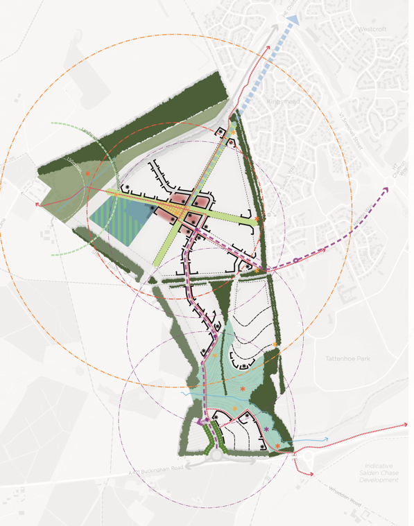
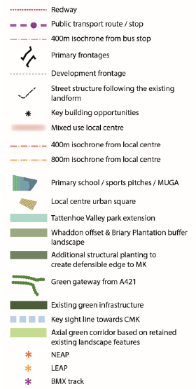
Figure 35: Placemaking Principles and 'Key Spaces and Places' (and key)
The Baseline Report analysis confirmed that one of the overarching design elements for the SPD was to draw on the distinct characteristics of a 'Site of two halves', adopting a varied design response to the layout and character of development north and south of Shenley Road:
- Northern 'Plateau' Neighbourhood of Briary Chase – linear layout incorporating existing green infrastructure elements and orientated along lines of existing /enhanced hedgerows, with a higher density mixed use local centre at its heart, focusing public activity, community and education uses around high quality public realm / open spaces designed to foster a lively and welcoming sense of place. Development here could take its cues from more urban and contemporary styles of housing within Kingsmead and Tattenhoe Park in the west and in and around the local centre, transitioning to lower density and more rural edge typologies to the north-west of the site;
- Southern 'Valley' Neighbourhood of Whaddon Valley – layout and character of buildings and public realm working with and heavily influenced by the topography. Predominantly residential, built development will run along, not across, the contours, using the south facing slopes, watercourse and the linear park as key design influences, resulting in more varied and bespoke design responses and housing styles (which could include self and custom build).
7.1 Identity (Built Form/Character)
The urban form and development patterns of Shenley Park will follow typical characteristics of nearby historic Buckinghamshire villages in the way they respond to their existing site levels and characteristics. As a general design principle, all development should seek to respond positively to and front edges where possible, and in certain arrangements where the side of block arrangements are only viable, passive surveillance should be provided through the careful positioning of key buildings fronting onto edges and/or dual frontages provided with well designed and integrated boundary walls and landscaping (following the AVA Design Guide principles). Figure 36 sets out the principle of the design approach to the development prioritising frontage development but also setting out the certain arrangements where alternative treatment may be required. Further guidance is provided as part of the edge conditions studies at 7.3.
Figure 36: Development edge treatment principles
Whilst the pattern of the built form will reflect that of historic Buckinghamshire settlements, the architecture will be contemporary to reflect the site's proximity to the Western Flank communities of MK and modern-day architectural styles and living requirements. The built form will be designed to reflect the principles in the AVA Design Guide.
Across Shenley Park a harmonious palette of architectural detailing and materials will be sought to ensure that whilst the characters of the northern and southern neighbourhoods can be distinct, the development is legible and reads well as a whole to its residents and visitors and this will be assessed further through detailed planning applications.
The extension of Tattenhoe Valley Park will create an attractive landscape corridor through the southern neighbourhood of Whaddon Valley accommodating planting, amenity open space, SuDS and habitat creation/enhancement. It will link seamlessly with the landscaped edges and corridors within and around the development, ensuring a connected green network for wildlife and leisure activities, as well as establishing a high quality green setting for built development.
Visual separation of Shenley Park from the Snelshall Priory Scheduled Ancient Monument will be maintained through the retention and enhancement of Briary Plantation Ancient Woodland and its protective buffer. The creation of a new link road connecting to H6 will be designed so as to minimise disturbance on the Ancient Woodland.
Development will respond positively to the existing MK Boundary Walk through well-designed design of buildings and open spaces, including good levels of surveillance and uninterrupted accessibility along the length of the Boundary Walk for pedestrians, cyclists and horse riders. Buildings and streets will be designed to prioritise provide public access / permeability and passive surveillance as well as the creation of a well-designed landscape corridor which will accommodate the required offsets from the existing vegetation.
Any excavation and recording of the Roman Settlement and other archaeological features present in and around the site will be reflected through the inclusion of interpretative boards at key locations as well as place signage. The archaeological and heritage assets within and around the site can also be used to inform the approach to and strategy for public art. Successful integration and interpretation can help instil a sense of ownership from the local community to the development and the nearby heritage assets and help create a distinctive development. This should be integrated into the layout for example as part of the play area design or local centre with consideration given to the long term management and maintenance.
7.2 Key Spaces and Places
There are a number of key spaces and places within Shenley Park where a particular or bespoke design response will be sought to ensure high quality placemaking outcomes and the following sections include a number of site studies in the locations shown below:
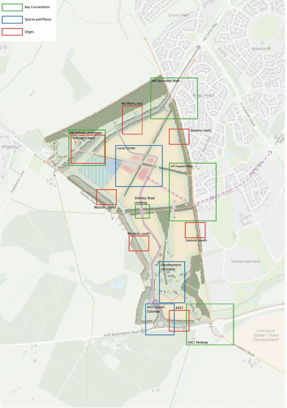
Figure 37: Location of Spaces and Places and Edges detailed below
Local Centre and Shenley Square (refer to figure 37 for location)
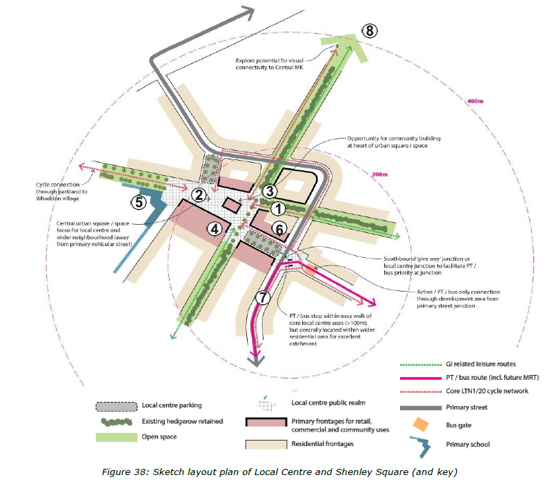
Figure 38: Sketch layout plan of Local Centre and Shenley Square (and key)
- Public square located at the heart of the local centre on the intersection of the axial green corridor, a flexible space to interact and/or dwell, designed for and capable of accommodating community/temporary events or small scale local market (farmer's market, community fetes and the like),
- Arrangement, mix and layout of local centre uses designed and laid out to prioritise walking and cycling and transit; rather than movements by private car;
- Located at the junction of the existing and retained hedgerows, enabling integration and access with the wider green infrastructure and public rights of way. Opportunities for key sightlines should also be explored, such as to the north east towards Central Milton Keynes;
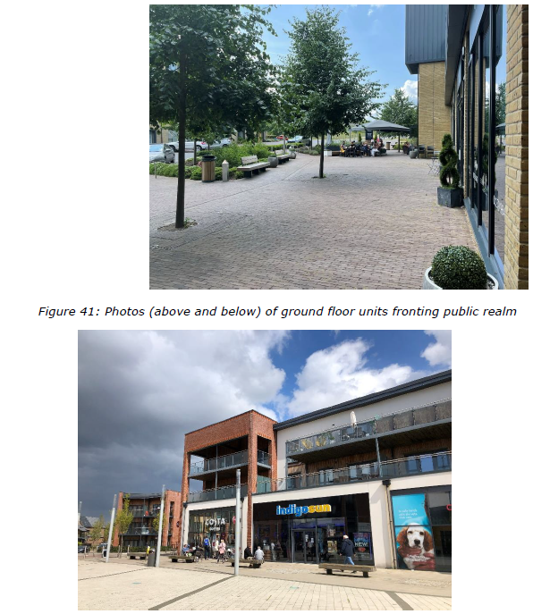
- The local centre should provide for flexible ground floor built form to key frontages as highlighted with the co-location of community facilities, retail, business support/small scale serviced office space, café/restaurant(s) and any health care facilities creating a real focus for the new community/residents. The mix of uses will be designed to have a positive interrelationship whilst minimising any conflict between the characteristics of different users/activities.
- The primary school building should also directly address the public square, with staff and servicing access provided for separately and should not be dominated by parking/drop off areas.
- The local centre also offers the potential for varied and higher density residential forms, such as apartments, urban town/mews homes, and later living accommodation – providing those that most need direct access to facilities and transit. This approach will also aid legibility and support higher levels of activity, the highest intensity / density of development at Shenley Park will be focused around the local centre with building heights also reaching their highest in this area.
- The priority public transport route shall pass directly adjacent to the local centre with a 'stop' appropriately located to ensure the local centre is well served but allows the public realm/central square space to be pedestrianised/pedestrian-focused. Opportunities to deliver priority for PT are also essential to providing for more sustainable movement – this could be provided at a key junction(s) within the core development area en route to the active/public transport only connection to H7 Chaffron Way. Legible and direct Redway connectivity with H6 and the wider area should also be provided.
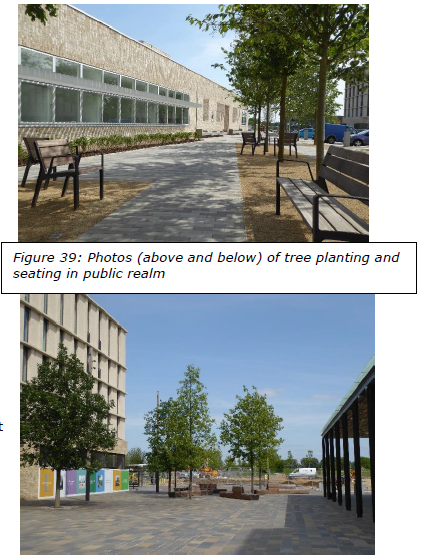
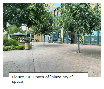
The local centre public realm and open space sitting at the heart of the development will provide a focal point for communal activities. It will include a 'plaza-style' space dominated by tree planting, and seating, with secure parking for bicycles. Any vehicular parking and servicing will be sensitively designed into the space and will not dominate the street scene. Opportunities for shared parking between different uses throughout the day (for example, school drop off and pick up times, beginning and end of the day for local shops, throughout the day for services) will be encouraged, in order to further encourage walking and cycling and to reduce the dominance of the car within the public realm.
Active frontages for ground floor units will activate the space, with potential for outdoor seating and dining to be provided where suitable. The public realm will be connected to the surrounding green spaces with clear vistas extending out along the existing and retained hedgerow corridors.
A421 Green Gateway (refer to figure 37 for location)
The entrance to Shenley Park from the south west announces not only the site, but forms a new gateway to the wider urban area.
Dominated by landscape and planting, with medium distance glimpses of high quality built development on the higher slopes to the north, it is expected that the junction with the A421 will be designed as a green gateway to Shenley Park.
- Built development will be set behind structural planting. Any public realm works and signage will be of high quality materials and not be overly dominant in the streetscape. Street tree planting will extend along the length of the link road to create a tree-lined legible primary route into the development.
- Structural planting will be the dominant element at the A421 junction and will run parallel to the A421 corridor and around both sides of the new junction providing screening and separation for the new development from the A421 for reasons of visual impact and amenity.
- Away from the A421 into the development area, formal tree planting in verges will supplement the street tree planting to create a strongly landscape dominated environment.
- Glimpsed through the structural planting and dominated by the landscape, built development shall respond positively to the gateway setting, appropriately designed with fronts or backs to reflect topography, appropriate overlooking and the need to minimise visual and noise intrusion from the A421 and junction.
- Public-facing boundary treatments to rear and/or side gardens shall be brick walls/walls with landscape boundary treatments.
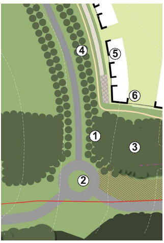
Figure 42: Sketch Plan and principles for A421 Green Gateway
7.3 Edge Conditions
Due to its landscape setting, and the importance attached to the network of existing green infrastructure which bounds the site, further specific guidance on how built development will interact positively with existing and new landscape features at various edge points is set out below. The location of the edge conditions studies is shown on figure 37 above. Each edge location includes the design response with and without the 'outer link' road in place to provide clear guidance which can be adapted if it is found through transport modelling, that the 'outer link' needs to be delivered and is not left as a safeguarded corridor.
Northern Edge (East) (refer to Figure 37 for location)
- Maintain a 50m wide protective buffer of 'parkland character' landscape for Briary Plantation Ancient Woodland to include:
- Provision of recreational path(s) and bridleway connections between the Whaddon offset landscape and the MK Boundary Walk
- Surface water attenuation features, as part of the sitewide SuDS strategy, designed as naturalistic features offering visual amenity and biodiversity value in addition to drainage functionality
- Creation of a 60m wide green corridor to accommodate the extension of Childs Way, Redways, associated structural planting and green infrastructure
- Where required noise attenuation shall be concealed within the structural planting
- Sensitive management of Briary Plantation to improve its quality and longevity as an Ancient Woodland
- Residential development with longer rear gardens generally arranged to 'back' on to the structural planting within 60m infrastructure corridor.
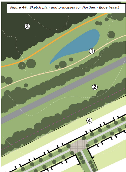
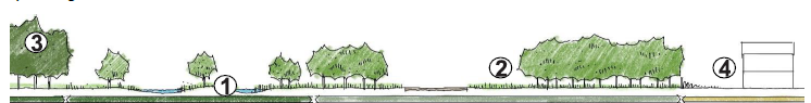
Figure 45: Section through Northern Edge (East)
Northern Edge (West) (Refer to figure 37 for location)
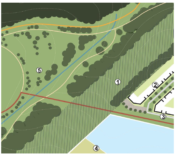
Figure 46: Sketch plan and principles for Northern Edge (West)
- Maintain a 60m wide reserve corridor for the potential extension of Childs Way
- To be created as a grassed corridor
- Structural planting to be implemented where residential development abuts the corridor. Planting belt to be a minimum width of 10m
- Residential development with longer rear gardens generally arranged to 'back' on to the structural planting within 60m infrastructure corridor
- Development to 'front onto' the new redway link and green corridor extending towards Whaddon to provide passive surveillance
- Formal sports provision and/or school playing fields are to be positioned adjacent to the 60m reserve corridor to contribute to the open separation between Shenley Park and Whaddon
- See principles for Whaddon Offset for further details relating to proposals north of the 60m reserve corridor
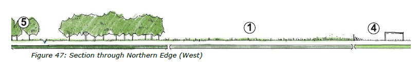
Figure 47: Section through Northern Edge (West)
Northern Edge (West) – with Outer Link (refer to figure 37 for location)
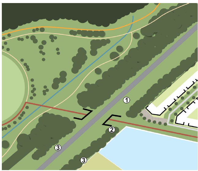
Figure 48: Sketch plan and principles for Northern Edge (West) with Outer link
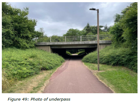
- Extension to Childs Way implemented if and when required in the future
- Construction of an underpass beneath Childs Way extension to provide uninterrupted connectivity for pedestrians/cyclists between Whaddon Village and Shenley Park
- Additional structural planting implemented within and along the length of the 60m corridor. Planting belts to be a minimum width of 10m.
- Where required noise attenuation shall be concealed within the structural planting
Western Edge (North of Shenley Road) (refer to figure 37 for location)
- Retain existing hedgerows and trees located along the site boundary
- Creation of a new defensible edge to MK with a 40m wide belt of structural planting
- Provision of recreational path(s) and bridleway within the structural planting
- Maintain a 40m wide reserve corridor for the construction of an outer link road should a more strategic vehicular connection be required (to be determined through modelling)
- To be created and maintained as a grassed corridor until requirement for road is confirmed
- Residential development generally arranged to 'back' on to the 40m reserve corridor with high quality landscaped boundary treatments
- Recreational path connections are to be provided from development parcels across the reserve linking to the paths within the structural planting belt
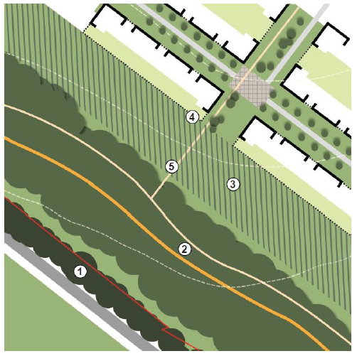
Figure 50: Sketch plan and principles for Western Edge (North of Shenley Road) (interim)
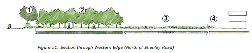
Figure 51: Section through Western Edge (North of Shenley Road)
Western Edge (North of Shenley Road) – with Outer Link (refer to figure 37 for location)
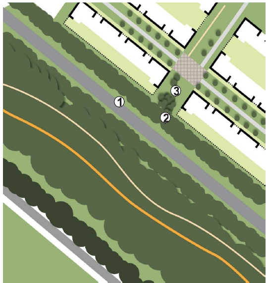
Figure 52: Sketch plan and principles for Western Edge (North of Shenley Road) with outer link
- Outer link road constructed within the 40m corridor as required based on modelling
- Structural planting implemented within and along the length of the 40m corridor. Planting belts to be a minimum width of 10m
- Where required noise attenuation shall be concealed within the structural planting
- Retention of recreational path connections extending from development parcels (subject to review on safety grounds if outer link required)
Western Edge (North of Shenley Road) –without outer link (refer to figure 37 for location
- Land within the reserve corridor reverts to net developable area and green infrastructure
- Residential development of this additional land generally arranged to 'front' on to the structural planting of the defensible edge of MK
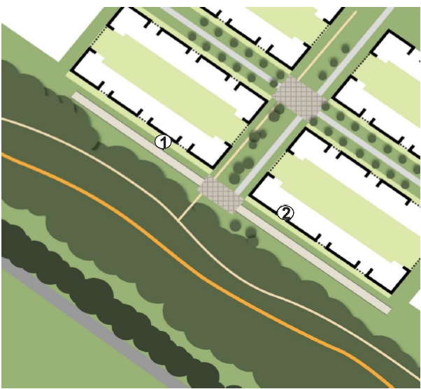
Figure 53: Sketch plan and principles for Western Edge (North of Shenley Road) without outer link
Western Edge (South of Shenley Road) (refer to figure 37 for location)
- The arrangement of streets and development is to reflect the natural topography of the site, minimising the need for earthworks and reprofiling
- Residential development generally arranged to 'side' on to the 40m reserve corridor
- Retain existing hedgerows and trees located along the site boundary
- Creation of a new defensible edge to MK with a variable width belt of structural planting responding to visual openness and landscape conditions west of the site. Structural planting to be a minimum of 10m at its narrowest but generally between 20-40m in width
- Provision of recreational path(s) and bridleway within the structural planting
- Maintain a 40m wide reserve corridor for the construction of an outer link road should a more strategic vehicular connection be required (to be determined through modelling)
- To be created and maintained as a grassed corridor until requirement for Outer Link is confirmed
- Recreational path connections are to be provided from development parcels across the reserve linking to the paths within the structural planting belt
- High quality design response required to address level changes within development and streets which retain the natural character and landform of the site, minimise the need for intrusive engineering and avoid extensive earthworks
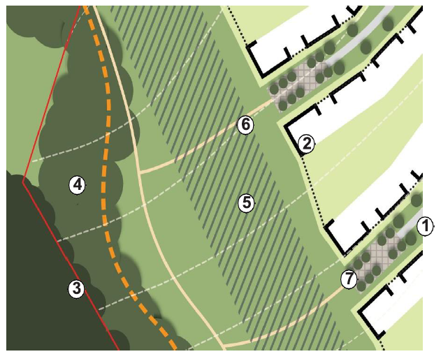
Figure 54: Sketch plan and principles for Western Edge (South of Shenley Road)(interim)
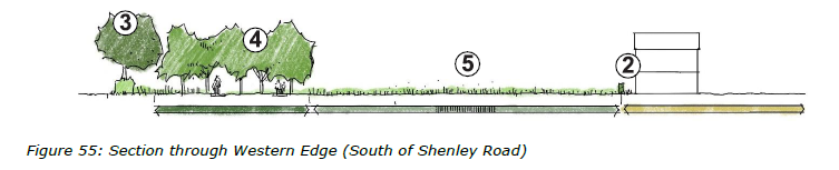
Figure 55: Section through Western Edge (South of Shenley Road)
Western Edge (South of Shenley Road) – with Outer Link (refer to figure 37 for location)
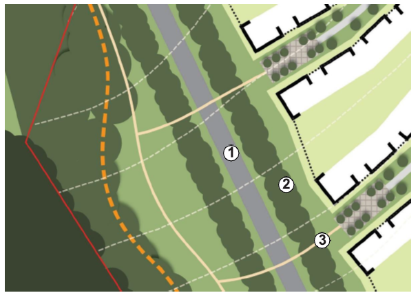
Figure 56: Sketch plan and principles for Western Edge (South of Shenley Road) with Outer Link
- Outer Link road constructed within the 40m corridor as required based on modelling
- Structural planting implemented within and along the length of the 40m corridor. Planting belts to be a minimum width of 10m
- Where required noise attenuation shall be concealed within the structural planting
- Retention of recreational path connections extending from development parcels to be reviewed on safety grounds
Western Edge (South of Shenley Road) –without Outer Link (refer to figure 37 for location)
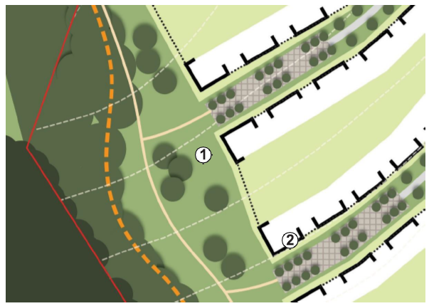
Figure 57: Sketch plan and principles for Western Edge (South of Shenley Road) without Outer Link
- Land within the reserve corridor reverts to net developable area and green infrastructure
- Additional residential development to be consistent with principles established above (in Framework Plan)
A421 Edge (refer to figure 37 for location)
- Maintain an 80m wide reserve corridor for the potential enhancement to the A421
- To be created and maintained as a grassed corridor until requirement for road is confirmed or not
- Retain all existing hedgerows and trees located along the site boundary except where land is required for access or dualling of A421
- Structural planting to provide a buffer between the A421 and the new development [north of the existing landscape belt]
- Where required noise attenuation shall be concealed within the structural planting
- The arrangement of streets and development is to reflect the natural topography of the site, minimising the need for earthworks and reprofiling
- Residential development generally arranged to 'side' on to the structural planting running parallel with the A421 corridor
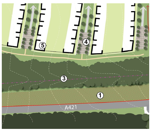
Figure 58: Sketch plan and principles for A421 Edge
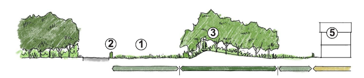
Figure 59: Section through A421 Edge
Eastern Edge (South of Shenley Road)(refer to figure 37 for location)
- Retain existing hedgerows and trees located along the site boundary where possible
- Development shall be set back the appropriate distance from existing green infrastructure, in accordance with the policy requirements
- Dual aspect properties are to be arranged to provide passive surveillance over the MK Boundary Walk green corridor and green spaces
- The arrangement of streets and development is to reflect the natural topography of the site, minimising the need for earthworks and reprofiling
- Recreational path connections are to be provided from Shenley Park to the MK Boundary Walk where possible
- Green corridors incorporating pedestrian routes should provide connectivity between streets, also contributing to stormwater collection, storage and conveyance as part of the sitewide SuDS network
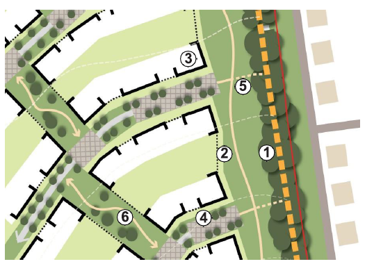
Figure 60: Sketch plan and principles Eastern Edge (South of Shenley Road)
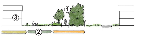
Figure 61: Section through Eastern Edge (South of Shenley Road)
Eastern Edge (North of Shenley Road) (refer to figure 37 for location)
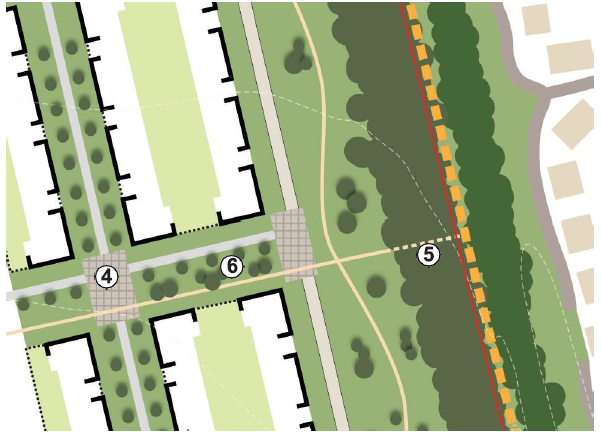
Figure 62: Sketch plan and principles Eastern Edge (North of Shenley Road)
- Retain existing hedgerows and trees located along the site boundary where possible
- Development shall be set back the appropriate distance from existing green infrastructure, in accordance with the policy requirements
- Dual aspect properties are to be arranged to provide passive surveillance over the MK Boundary Walk green corridor and adjacent green spaces
- The arrangement of streets and development is to reflect the geometric layout of the existing hedgerows, with a clear and legible structure which connects to the Local Centre, open spaces and Milton Keynes
- Recreational path connections are to be provided from Shenley Park to the MK Boundary Walk where possible
- Green corridors incorporating pedestrian routes should provide connectivity between streets, also contributing to stormwater collection, storage and conveyance as part of the sitewide SuDS network
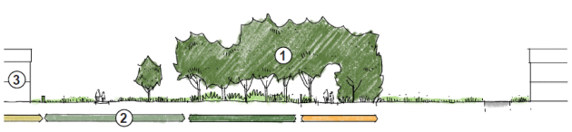
Figure 63: Section through Eastern Edge (North of Shenley Road)
7.4 Bespoke Design Responses
It is expected that best practice design as set out in Aylesbury Vale Area Design Guide Supplementary Planning Document will be the basis upon which detailed development proposals are drawn up.
The need to design with the existing undulating topography of the southern part of the site, and the importance of retaining and enhancing the cross boundary network of existing green and grey infrastructure which currently permeates through the site requires a bespoke design response to certain development areas.
Specific guidance on how built development will interact positively with these features is set out below and the location of the studies are shown on figure 15 above.
Development on slopes (refer to figure 37 for location)
- Minimise the need for reprofiling through the layout and design of streets and housing to work positively with the existing landform, therefore positively engaging with this topography as part of creating a successfully landscape led development.
- Align streets to achieve accessible gradients naturally.
- Non-standard house types should be used where necessary for development to work positively with the existing landform which minimise overlooking, and maximise opportunities for roof gardens and balconies and where possible dealing with level changes within the buildings such as the through the use of design solutions such as split level bespoke buildings.
- Stormwater attenuation features will be sensitively located, designed and scaled in order for them to integrate into the open spaces.
- Minimise the need for hard engineering solutions to ground stabilisation and minimising the need for retaining structures. Where needed, they must not compromise the viability of amenity spaces through overshadowing or reducing the useable amenity area.
- Maximise opportunities for solar generation with south-facing roofs.
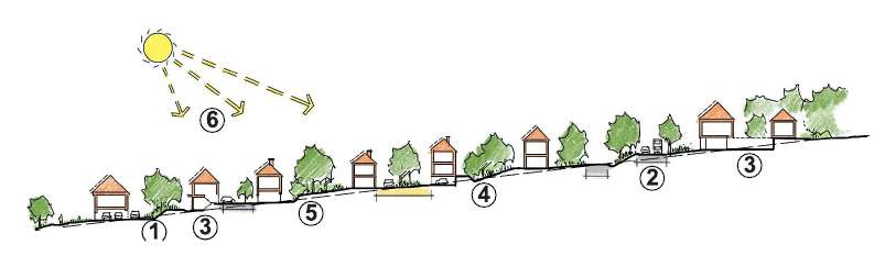
Figure 64: Example section of approach to development on slopes
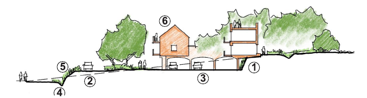
Figure 65: Example of design solutions working positively with the levels
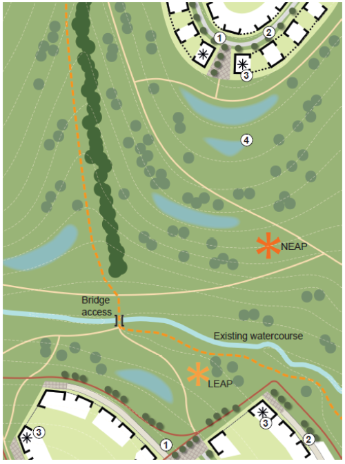
Figure 66: Sketch plan of development fronting Valley Park Extension
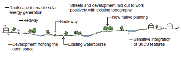
Figure 67: Section through Valley Park Extension


